BlueChart g2 Vision - Aegean Sea and Sea of Marmara - Maps
Model: Brand: Garmin
BlueChart g2 Vision offers the same rich detailed charting of BlueChart g2 to help you get the most out of your unit. In addition, g2 Vision features a growing database of high-resolution satellite imagery, above and below the water 3D perspective, auto guidance technology, aerial photographs for real world reference and coastal roads with points of interest. This product features coverage of all of the Greek coast and Aegean Sea; Turkey from Istanbul and Sea of Marmara to Antalya; and Brindisi, Italy. « less
Product Specification
-
General
Product Type: MapsDistribution Media: SD Memory CardFirst Seen On Google Shopping: June 2007 -
Compatibility Information
Designed For: Garmin GPSMAP 4008, 4012, 420, 4208, 420s, 4212, 430, 430s, 430sx, 430x, 440, 440s, 440sx, 440x, 450, 5008, 5012, 520, 5208, 520s, 5212, 525, 525s, 530, 530s, 535, 535s, 540, 540s, 545, 545s, 550, 550s, 555, 555s -
Universal Product Identifiers
Part Numbers: 010-C0773-00, Aegean Sea and Sea of MarmaraGTIN: 00753759069537
Related Products
-
Explorer + Black Box Chartplotter without GPS Sensor
-
iScan V90 Forward Looking Sonar 16407
-
BlueChart g2 Vision - Lake Michigan - Maps
-
BlueChart g2 Vision - Lake Superior - Maps
-
Marine Naviled Pro Port Navigation Light
-
30ft 24AWG Cat5e 350MHz UTP Bare Copper Ethernet Network Cable - Yellow
-
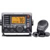
m504a-61 Submersible Plus Class D DSC VHF Marine Radio Blac
-
100ft 14AWG CL2 Rated 4-Conductor Loud Speaker Cable (for
-
18inch SATA Data and Power Combo Cable - Silver
-
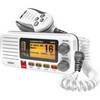
Fixed Mount VHF Marine Radio Whit UN-U*415
-
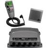
VHF 300 AIS VHF Radio with AIS Receiver
-
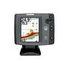
700 Series 747c - Fishfinder - included transducer : XNT-9-20-T - dual-beam