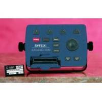
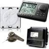
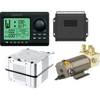
Explorer + Black Box Chartplotter without GPS Sensor
Model: Brand: Si-Tex
Manuals Charting Systems GPS-95CP (1.2MB) Trawl Plot 12SD (4MB) Chart Plotters (7.4MB) (Includes: Color - Max11, ColorMaxPro, Color - Max Sea Link, Explorer Plus, & Nav - Mate) The EXPLORER PLUS turns almost any "off the shelf" PC monitor into a full-featured C-MAP electronic charting system. Couple this unique product to an existing onboard monitor or add just about any size CRT or flat panel display for a very convenient two piece charting system with unlimited mounting possibilities. designed for Specifications Compact controller unit connects to most standard monitor with VGA input. Straightforward logic and soft key operating system offers uncanny ease of operation. Waterproof trackpad provides smooth cursor transitions to plot, scroll, pan and make menu selections. Compatible with the new C-MAP MAX charts, technically the most innovative C-MAP charts ever designed. Dual slot C-MAP MAX/NT+ cartridge doubles the charting capability. A unique programmable anti-grounding feature using? Guardian Grounding Alarm* provides alarms if your current course takes you within danger of shoals, obstacles or other areas where the water is too shallow for your vessel's draft. This feature helps provide an added level of security for all boaters. Available with or without GPS/WAAS sensor and with external GPS/Loran receiver for True Loran Positioning as model Explorer Plus - Perfect for use with the optional SI-TEX GPS-20 model sensor. Position displayed when connected to GPS. Expands to an all-in-one GPS Charting System/Fishfinder/Radar with optional ES502 Fishfinder Module and optional 2k - W to 4k - W MDS Radar Sensors. Displays tidal data and port service information for selective areas worldwide from local C-Card. Up to 1000 Waypoints, Mark or Events and 5000 points per track. Control unit can be mounted up to 6 feet away from display unit, multiplying the mounting options on any vessel. In addition to charting information, EXPLORER PLUS numerically indicates speed, course, distance, arrival time, STG, temp and depth when interfaced with proper sensors. Charting is displayed in North-up or Course-up modes with GPS input. Controller unit is designed to be either tabletop, bulkhead or flush mounted. Special trunion bracket and mounting knobs are provided for easy installation and removal. NMEA-0183 data port for interfacing with other onboard electronics. Optional memory cards provide unlimited track and waypoint storage capability. Guardian Grounding Alarm* feature continuously scans the electronic chart data in front of the boat to detect charted rocks, shoals, obstructions and areas that could pose a threat if the vessel were to continue along its current course. The area searched is user-definable and is identified by a triangle on the screen. Triggering timely and clear alarms. OPTIONS Add full-features color fishfinder capabilites! Optional ES502 Dual Frequency 50/200 k - Hz Fishfinder Module connects to your Trawl - Plot 12SD Charting System to add full featured color fishfinder capabilities. Split-screen chart/ fishfinder. Add Full Featured Radar Capabilities! SI-TEX MDS Radar Sensor Series connect to your SI-TEX Trawl - Plot 12SD Charting System to add affordable full-feature radar capabilities and are available in 2k - W to 4k - W Open Arrays Assists in Traffic Monitoring, Management and Collision Prevention! SI-TEX AIS Black Box receives VHF transmissions from vessel carrying automati identifcation system transponders. Connects to Trawl - Plot 12SD Charting System to display target data from an unlimited number of vessels and overlay AIS target data on marine charts. Easy to install and requires optional standard marine VHF antenna. Provides True Loran Positioning and Repeatable Accuracy! Trawl Plot 12SDL is provided with SI-TEX e-LORAN Integrated GPS WAAS/Loran Receiver to give you the best of both worlds... Perfect for finding that old Loran-C Fishing Hot Spot. Provides Heading Better Than 1 Accuracy! Add Cameras! Optional CAM-251 indoor camera Bronze Thru-Hull Transducer (shown). Full chart plus graphic depth display. Add Depth Graph Feature! Optional Active Transducers add Depth Graph feature which allows you to display graphic presentation of vessel's current depth and recent depth history. Multiple housing mounting options available. Any electronic navigation device should be operated along with the prudent use of reliable manual backup material. Specifications subject to change without notice. « less
Product Specification
-
Universal Product Identifiers
Part Number: wexplorer
Related Products
-
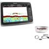
Package(c127 with aus, NZ, S. America, Asia Chart, 4KW 24 Inch Digital Radome & Radar Cable)
-
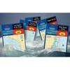
Waterproof Chart Kit - Cape Ann Mass. to Portalnd, Maine
-
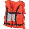
6000org-00-000 Merchant Mateiiflotation Vest Nylon Univ Org
-
AP2802 Autopilot System AP28 AC42 RC42 RF300 No Drive
-
AP2804VRF Autopilot System
-
LED Bicolor Light Black 12V
-
40 Stern Yellow Nav Light 12v/10w
-
3ft 24AWG CL2 Flat High Speed HDMI Cable - Black
-
3ft RG6 (18AWG) 75OHM, Quad Shield, CL2 Coaxial Cable with F Type Connector - White
-
B260-10F 1kW Thru-Hull Transducer Furuno 10-Pin Connector
-
TM00421 1 Rod Holder Rack
-
3010 Thru Hull Underwater Light - Super White
