BlueChart g2 Vision - Lake Michigan - Maps
Model: Brand: Garmin
BlueChart g2 Vision offers the same rich detailed charting of BlueChart g2 to help you get the most out of your unit. In addition, g2 Vision features a growing database of high-resolution satellite imagery, above and below the water 3D perspective, auto guidance technology, aerial photographs for real world reference and coastal roads with points of interest. This product features detailed coverage of Lake Michigan in its entirety and northern Lake Huron from Cheboygan, MI, to Blind River, Ont., including Sault Ste. Marie and Cockburn Island. « less
Product Specification
-
General
Product Type: MapsDistribution Media: SD Memory CardFirst Seen On Google Shopping: May 2007 -
Compatibility Information
Designed For: Garmin GPSMAP 4008, 4012, 420, 4208, 420s, 4212, 430, 430s, 430sx, 430x, 440, 440s, 440sx, 440x, 450, 5008, 5012, 520, 5208, 520s, 5212, 525, 525s, 530, 530s, 535, 535s, 540, 540s, 545, 545s, 550, 550s, 555, 555s -
Universal Product Identifiers
Part Numbers: 010-C0717-00, Lake MichiganGTIN: 00753759068974
Related Products
-
SmartCast RF45 - Transducer - single-beam
-
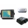
Radar 4008 Package with GMR24HD 4KW Radome & GSD22 Sounder
-
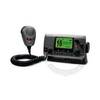
VHF 100 Marine Radio - VHF - 10 Weather - 25W
-
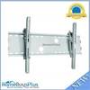
Adjustable Tilting Wall Mount Bracket for LCD LED Plasma (Max 165Lbs, 30~63inch) - Silver (No Logo)
-
Manhattan iLynk 2-in-1 Cable - iPad / iPhone / iPod / cellular phone charging / data cable kit
-
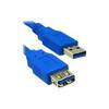
USB extension cable - 9 pin USB Type A - M - 9 pin USB Type A - F - 10 ft - PC
-
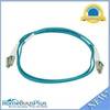
10gb Fiber Optic Cable, LC/LC, Multi Mode, Duplex - 1 Meter
-
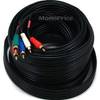
35ft 22AWG 5-rca Component Video/audio Coaxial Cable (RG-59/U) - Black
-
T-H Marine TH7592B; 3/4 90 Degree Thru-Hull White Fitting
-
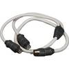
Marine Twisted-Pair Y-Adapter Cable - XMD-WHTAIC1M2F
-
Cat6a Ethernet Cable | 35ft | Gray | Network | 10 Gigabit
-
AIS Dual Synthesised Rcvr w/GPS SLR-200G