BlueChart g2 Vision - Lake Superior - Maps
Model: Brand: Garmin
BlueChart g2 Vision offers the same rich detailed charting of BlueChart g2 to help you get the most out of your unit. In addition, g2 Vision features a growing database of high-resolution satellite imagery, above and below the water 3D perspective, auto guidance technology, aerial photographs for real world reference and coastal roads with points of interest. This product features detailed Lake Superior and northern Lake Huron are covered in detail for the U.S. portion from Duluth through Alpena, including Crooked Lake, Burt Lake, and Mullett Lake in Michigan; and for the Canadian portion from Thunder Bay to Tobermory, Ont. « less
Product Specification
-
General
Product Type: MapsDistribution Media: SD Memory CardFirst Seen On Google Shopping: May 2007 -
Compatibility Information
Designed For: Garmin GPSMAP 4008, 4012, 420, 4208, 420s, 4212, 430, 430s, 430sx, 430x, 440, 440s, 440sx, 440x, 450, 5008, 5012, 520, 5208, 520s, 5212, 525, 525s, 530, 530s, 535, 535s, 540, 540s, 545, 545s, 550, 550s, 555, 555s -
Universal Product Identifiers
Part Numbers: 010-C0716-00, Lake SuperiorGTIN: 00753759068967
Related Products
-
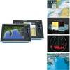
G10 10" Mfd W/2KW Sonar 408020-1
-
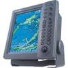
RDP150 12.1 Color LCD Radar Display
-
Marine Chart A
-
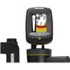
Fishin' Buddy 140c - Fishfinder - portable - included transducer - single-beam
-
MT-403FFSVC Hydrostatic Release for MT-403FF & MT-403FG
-
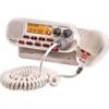
Mr F55-D Marine Class-D DSC Technology Fixed Mount 25-Watt
-
9403 Replacement Lamp for RCL-75, 55W, 12V
-
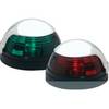
5040SS1 Stainless Pulsar Nav. Lights
-
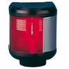
40300-7 S40 Port Navigation Light 12v/25w
-
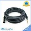
35ft Premier Series XLR Male to 1/4inch TRS Male 16AWG Cable (Gold Plated)
-
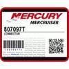
/ Quicksilver 807097T Connector
-
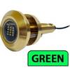
Lumishore Thru Hull Flush Fit 18 Watt Green Underwater Light 41681