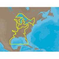
30128 Max - U.S. Gulf Coast and Inland Rivers - C-Card
Model: 30128 Brand: C-Map
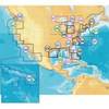
NA-M023 => Gulf of Mexico, Great Lakes and Rivers Coverage of the Gulf states, starting from Boca Raton, FL, down to Key West, FL, then back up and around the Gulf to Brownsville, TX. Also includes coverage of all the Great Lakes: Erie, Superior, Ontario, Huron and Michigan. Coverage of the Great Lakes also includes Fox River and Lake Winnebago, Lake St. Clair and the Trent-Severn Waterway. River coverage includes the Mississippi River, Ohio River, Illinois River, Arkansas River, Red River, Ouachita River, Tennessee River, Cumberland River, Tenn-Tom Waterway and the Black Warrior River. Other smaller rivers are also included: Green River, KY, Kanawha River, WV, Allegheny and Monongahela Rivers, PA and Kankakee River, IL. Additional coverage of the Hudson River, including Lake Champlain, down to New York City, the Erie Barge Canal and partial coverage of the St. Lawrence River up to Montreal. « less
Product Specification
-
Universal Product Identifiers
Part Numbers: 30128, NA-M023, NA-M023.00, NA-M023C-CARDGTIN: 000000165837, 00686074002739
Related Products
-
BlueChart g2 Vision - Lake Erie - Lake St. Clair - Maps
-
MSD/645P+ Platinum Plus North Carolina on SD/MicroSD
-
Waterproof Charts 123F Coastal Miami Trolling Chart - FISH/DIVE
-
FBRS 2775 Battery Serive Includes 1096 Batt Parts Labor
-
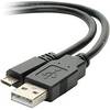
USB 2.0 A Male to Micro-B Male Cable 1.5 ft.
-
70 Allround Red Nav Light
-
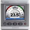
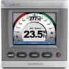
GMI 10 3.5 Inch NMEA 2000 Compatible Marine Instrument 010-00687-00 c31909
-
100ft 12AWG CL2 Rated 4-Conductor Loud Speaker Cable (for In-Wall Installation)
-
0100068710 GMI 10 3.5" NMEA 2000 Compatible Marine Instrument
-
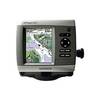
GPSMAP 441s - Marine GPS receiver - 4" color - 240 x 320
-
Network cable - CAT 6 - RJ-45 - M - Unshielded twisted pair (UTP) 75 ft - Black
-
14023 HDS-5m Chart/Gps-No Fishfinder