BlueChart g2 Vision - Lake Erie - Lake St. Clair - Maps
Model: Brand: Garmin
BlueChart g2 Vision offers the same rich detailed charting of BlueChart g2 to help you get the most out of your unit. In addition, g2 Vision features a growing database of high-resolution satellite imagery, above and below the water 3D perspective, auto guidance technology, aerial photographs for real world reference and coastal roads with points of interest. This product features coverage of both the U.S. and Canadian sides of the southern portion of Lake Huron. Detailed coverage of the St. Clair River, Lake St. Clair, Detroit River, and the U.S. portion of Lake Erie through Buffalo. Also includes coverage of the Canadian portion of Lake Erie and the western side of Lake Ontario, including detailed coverage of Long Point Bay, Welland Canal, the Niagara River, and Toronto. « less
Product Specification
-
General
Product Type: MapsDistribution Media: SD Memory CardFirst Seen On Google Shopping: May 2007 -
Compatibility Information
Designed For: Garmin GPSMAP 4008, 4012, 420, 4208, 420s, 4212, 430, 430s, 430sx, 430x, 440, 440s, 440sx, 440x, 450, 5008, 5012, 520, 5208, 520s, 5212, 525, 525s, 530, 530s, 535, 535s, 540, 540s, 545, 545s, 550, 550s, 555, 555s -
Universal Product Identifiers
Part Numbers: 010-C0719-00, Lake Erie - Lake St. ClairGTIN: 00753759068998
Related Products
-
U1-CHRT-PRO Chartmaster Pro Combo - External
-
Chartmaster 169CS (u1-Chrt-169i)
-
LPS - 1 Hand - Held Digital Sonar Depth Finder
-
FR8062 12.1 Color LCD 6KW 15 Meter Cable No
-
Radar Pole Mount 6' Kit for Raymarine 2KW and 4KW
-
9469 17 Foot Harness for 2nd Station on 1946
-
GSC Autopilot No Rudder Feed Back or Drive 700048-1
-
20ft 24AWG Cat5e 350MHz UTP Bare Copper Ethernet Network Cable - White
-
3ft 24AWG Cat5e 350MHz UTP Bare Copper Ethernet Network Cable - Orange
-
USB 3.0 | Extension Cable | 3ft | Type A | Male/Female | Black
-
010-11095-00 NMEA 2K Female Connector
-
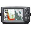
900 Series 957c Combo NVB CHO - Marine Chartplotter - 8" color - 800 x 480 - widescreen