Western U.S. Fishing Maps Sea of Cortez North Chart
Model: Brand: Fish-n-Map
FISH-N-MAP UNDERWATER TOPOGRAPHY MAPSMade of waterproof, tear resistant plastic. Features include: underwater depth contours, fish locations, latitude and longitude for GPS, multiple freshwater lakes on one map, boat ramps, recreational facilities and much more.
Product Specification
-
Universal Product Identifiers
Part Numbers: 317166, 7123GTIN: 00761428071231
Related Products
-
FAP7002 Processor for 700 Series Autopilot
-
Marine Pollution Including Ocean Acidification, Eutrophication, Marine Debris, Mercury in Fish, and Active Sonar [Book]
-
T-921 Radar with 2KW 18" Radome
-
IR2 4.4 4KW 4.5 Foot Open Array Radar R-0006
-
PAPR03; Region 3 Paper Chart Kit
-
EW-C207 C-Card Format Bristol Channel & Irish Sea
-
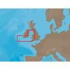
010-C0774-20 Bluechart G2 HXEU016RMediterranean Southeast
-
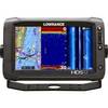
00010777001 HDS-12 Touch G2 Insight 50/200
-
CA50B-6B 50kHz Rbr Coat F/ 1kW Units
-
Articulating All Round Pole Light, 48 Inch
-
Whisper Whi-500, 3 KW (24Mph Wind) Wind Turbine with Controller (24V)
-
GPSMAP 182 - Marine GPS receiver - 5.5" monochrome - 360 x 240