010-C0774-20 Bluechart G2 HXEU016RMediterranean Southeast
Model: 010-C0774-20 Brand: Garmin
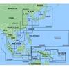
See your surroundings more clearly with BlueChart g2 data. With BlueChart g2, you'll get detailed marine cartography that provides convenient viewing of nautical content. BlueChart g2 allows you to see your vessel's precise, on-chart position in relation to naviads, coastal features, anchorages, obstructions, waterways, restricted areas and more. You will also have access to detailed mapping capabilities that include Safety Shading, Fishing Charts, smooth data transition between zoom levels, harmonious transition across chart borders, and reduction of chart discontinuities. Covers: From Gulluk, Turkey east to include Cyprus, Syria, Lebanon and Israel, then west to Misratah, Libya. « less
Product Specification
-
Universal Product Identifiers
Part Numbers: 010-C0774-20, 10805083, 35622GTIN: 00753759091729
Related Products
-
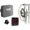
AP5002 Autopilot with AP50, J50, Rudder Feedback RF300, RPU 80 Drive Unit
-
Marine Lighting, LED, Bulkhead Mount, Ocean Chart Lamp, 10 - 30V DC, Medium, Stainless Steel Finish, Warm
-
MapSource BlueChart - Yellow Sea - Maps
-
Marine ILIM4060 Auckland LED Reading Chart Marine Light
-
NT+ Wide Chart (New Zealand & Australian & Asia Region)
-
T70015 SPX-5 Wheelpilot Pack w/p70 Control Head
-
70 Stern Yellow Nav Light
-
3ft 28AWG High Speed HDMI Cable w/Ferrite cores - Orange
-
1.5ft 28AWG High Speed HDMI Cable w/Ferrite cores - Green
-
/ Quicksilver 22-18922 Oil Reservoir Connector
-
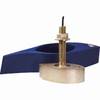
B260-6BR 1kW Thru-Hull Transducer Garmin 6-Pin Connector
-
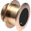
B175-0-L Broadband CHIRP, No CONNECTOR, Depth & Temperature Thru-Hull Tilted