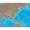
PAPR03; Region 3 Paper Chart Kit
Model: PAPR03 Brand: Maptech
ChartKits are full-color reproductions of U.S. government and private charts spiral bound into popular cruising regions with aerial photos, pre-plotted courses and more. The convenient-sized books are large enough to allow for manual plotting, yet small enough to sit on your nav-station or lap. Waterproof covers are available. « less
Product Specification
-
Universal Product Identifiers
Part Number: PAPR03
Related Products
-
SP-80MT Autopilot for Cable Steer Tilt Type Helms st80mt
-
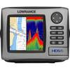
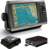
HDS-5 Lake Insight Multifunction w/o Trans 34242
-
Package(e95 with aus, NZ, S. America, Asia Chart, 4KW 24 Inch Digital Radome & Radar Cable)
-
AN-M203 C-Card Format Yellow Sea & Malaya
-
Marine Navigation: Celestial and electronic [Book]
-
Marinenav Leviathan Marine Navigation PC Computer LEV-017R-Intel
-
2668 25ft Optical Toslink 5.0mm OD Audio Cable
-
Patch cable - CAT 6 - RJ-45 - M - Unshielded twisted pair (UTP) 10 ft - Gray
-
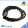
3ft Premier Series XLR Male to RCA Male 16AWG Cable (Gold
-
TM00701 Power Connector Plastic
-
PMA-5G-7L Power Mount with Light Bracket Option -LTB Not Included (PMA-57-M1 + ADA-R1) c16803
-
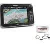
GPSMAP 4208 Network Bundle Includes GSD22 & Gxm51