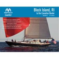
PAPR08; Region 8 Paper Chart Kit
Model: PAPR08 Brand: Maptech
ChartKits are full-color reproductions of U.S. government and private charts spiral bound into popular cruising regions with aerial photos, pre-plotted courses and more. The convenient-sized books are large enough to allow for manual plotting, yet small enough to sit on your nav-station or lap. Waterproof covers are available. « less
Product Specification
-
Universal Product Identifiers
Part Number: PAPR08
Related Products
-
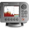
1158C HD Combo 407980-1
-
Radar 4210 Package with GMR24HD 4KW Radome & GSD22 Sounder
-
Radar 5215 Package with GMR24HD 4KW Radome & GSD22 Sounder
-
Rsb118092 4KW Gearbox for Drs4a Openarray System
-
080 Marine Navigation Chart Case
-
Marine ILIM4060 Auckland LED Reading Chart Marine Light
-
Max EW-M227 W3 Norhtwest European Coasts-MAX
-
AP2403 Autopilot System AP24 AC12 RC42 RF300 RPU80
-
Marinenav Leviathan Marine Navigation PC Computer LEV-017R-AMD
-
Serial cable - (DB-37) - M - 10 ft - PC
-
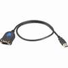
AS-USB Serial to USB Adapter 760018-1
-
34210 A50D 5" Combo w/ Coastal Maps, Int GPS