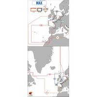
Max EW-M227 W3 Norhtwest European Coasts-MAX
Model: EW-M227 Brand: C-Map
Product Specification
-
Universal Product Identifiers
Part Number: EW-M227
Related Products
-
T70016 SPX-5R w/p70R Control Head
-
Sonar Ready Adaptor Cables
-
E97 Multifunction 9" Display with Sonar - European Charts T70043 c44344
-
DRS25A NAVNET3D 25KW Gearbox Requires Antenna
-
PAPR03; Region 3 Paper Chart Kit
-
8268; Map-The Delta
-
Waterproof Chart Kit - Cape Ann Mass. to Portalnd, Maine
-
5ft 24AWG Cat6 550mhz UTP Ethernet Bare Copper Network Cable - Red
-
M504A 53 M504 Gray VHF - Rear Mic Version
-
99-70 SP-X Speed Probe X-seriex Connector
-
1927.3 Master Controller URC-102
-
Cat6a Ethernet Cable | 50ft | Gray | Network | 10 Gigabit
