Chapman Nautical Chart No. 1: The Essential Guide to Chart Reading and Navigation [Book]
The essential reference tool for reading maps, published by the Coast Guard, is now available to boaters in an attractive, colorful edition that includes important supplementary information about navigation. A must-have for all mariners, the first half of the manual reproduces the U.S. Coast Guard book, with coverage of basic chart concepts, the anatomy of a chart, how to read a chart, symbols and abbreviations associated with National Ocean Service and Defense Mapping Agency charts, and the chart numbering system. In addition, for extra value, the USCG version has been expanded to include navigation tips and techniques from Chapman Piloting and Seamanship, 64th edition, including details on positioning procedures, dead reckoning, and river piloting. « less
Product Specification
-
Authors: John Wooldridge, John Wooldridge United States Coast Guard United States Coast GuardPages: 201Format: paperbackPublication Date: October 1, 2004Key Terms: daybeacons, Notices to Mariners, nautical charts, nautical miles, racon, IALA, Light Lists, compass rose, Radar, statute miles, U.S. Coast Guard, Morse Code, trom, chart datum, Loran-C, Anchorage, World Geodetic System, GEOGRAPHIC COORDINATES, Degaussing, Cape Hatteras
-
Universal Product Identifiers
ISBN: 1588164004GTIN: 09781588164001
Related Products
-
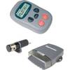
S1000 Wireless Autopilot System
-
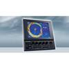
CH270/324 180 kHz Searchlight Sonar System with 10.4 Inch Color LCD Display. Includes 350mm Travel Hoist and Operates at 24 and 32VDC
-
Dx64s1 24 4KW Radar Dome Wprocessor and 15m Cable
-
NA-M026 C-Card Format Great Lakes and The Maritimes
-
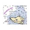
Puget Sound (Small Craft) Chart
-
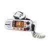
OCEANUSDSC VHF Two-way radio
-
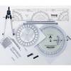
100 Marine Navigation Coast Guard Navigation Tool Kit
-
Power Bright 2 AWG 3 ft Battery Cables
-
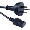
Cable Showcase Austrailian Power Cord UL/CSA, 6 ft
-
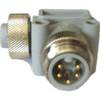
ELB-NM-NF Mini 90 Deg. Male to Female Connector
-
B260-BB 1kW Thru-Hull Transducer Standard 8-Pin Connector
-
GPSMAP 536 - Marine Chartplotter - 5" color - 480 x 640