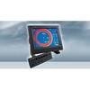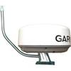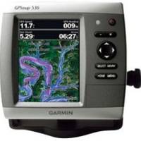
GPSMAP 536 - Marine Chartplotter - 5" color - 480 x 640
Model: 536 Brand: Garmin
The GPSMAP 536 is a compact chartplotter that features a high-resolution, super-bright 5" VGA color display along with an improved high-speed digital design for increased map drawing and panning speeds. It's ready to go with a built-in, satellite-enhanced basemap and an easy-to-use interface designed to help you navigate the open waters with ease. The GPSMAP 536 also accepts BlueChart g2 Vision cards for added features and functionality such as high-resolution satellite imagery, 3-D views and Auto Guidance technology. The GPSMAP 536 has a worldwide basemap with satellite images in place of more traditional maps. The GPSMAP 536 also comes standard with a high-sensitivity GPS receiver for superior satellite tracking and quicker acquisition times. With an SD card slot, it's easy to add additional maps without connecting to a computer. The GPSMAP 536 is also NMEA 2000-certified for easy connectivity with sensors, instruments and future marine offerings. « less
Product Specification
-
General
Product Type: ChartplotterRecommended Use: MarineCard Reader: SD Memory CardInterface: NMEA 0183, NMEA 2000Functions & Services: Tide TabIncluded Software: MapSource BlueChart Inland Lakes: United StatesCompatible Software: BlueChart g2 VisionFeatures: Optional external GPS antenna connection, XM weather supportFirst Seen On Google Shopping: February 2011 -
Display
Type: LCD - colorDiagonal Size: 5"Resolution: 480 x 640 -
Navigation
Waypoints: 3000Tracks: 50Tracklog Points: 20000Routes: 100Trip Computer: Sun/moon positions -
Miscellaneous
Protection: WaterproofWaterproof Standard: IPX7Included Accessories: Protective cover, mounting bracket, power/data cable -
Dimensions & Weight
Width: 5.9 inDepth: 2.9 inHeight: 6.4 inWeight: 1.8 lbs -
Universal Product Identifiers
Part Numbers: 010-00773-00, 536GTIN: 00753759096137
Related Products
-
CH250BB/88/225 88 kHz Black Box Searchlight Sonar System. Includes 250mm Travel Hoist and Operates at 12VDC
-
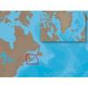
NA-C205 C-Card Format - Fundy Nova Scotia Pei Cape Br
-
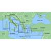
MapSource BlueChart - Adriatic Sea, North Coast - Maps
-
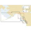
Electronic Chart - Cape CAUTION to Portland Canal, BC NA-C703
-
Max EN-M604 W34 Russian Lakes-MAX
-
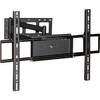
Adjustable Tilting/Swiveling Wall Mount Bracket for LCD LED
-
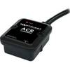
2675 Nauticast AIS Dual Channel Receiver
-
1554 6ft Mini Optical Toslink M/M 5.0mm OD Molded Cable
-
Marine -9-72653 PLUG,DRAIN
-
PMA-5G-7LSS 5" Stainless Steel Power Mount
-
1-AR30-10-12 Air 30 Wind Generator 12VDC
-
ONIX400 - Hiking GPS receiver - 3.5" color - 320 x 240