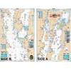
BlueChart g2 Vision - Hecate Strait South - Maps
Model: Brand: Garmin
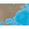
BlueChart g2 Vision offers the same rich detailed charting of BlueChart g2 to help you get the most out of your unit. In addition, g2 Vision features a growing database of high-resolution satellite imagery, above and below the water 3D perspective, auto guidance technology, aerial photographs for real world reference and coastal roads with points of interest. This product features coverage of the southern portion of the Queen Charlotte Islands, Hecate Strait, Queen Charlotte Sound, and Queen Charlotte Strait. Includes detailed coverage of many areas including Port Hardy, BC, Burke Channel and Dean Channel. « less
Product Specification
-
General
Product Type: MapsDistribution Media: SD Memory CardFirst Seen On Google Shopping: May 2007 -
Compatibility Information
Designed For: Garmin GPSMAP 4008, 4012, 420, 4208, 420s, 4212, 430, 430s, 430sx, 430x, 440, 440s, 440sx, 440x, 450, 5008, 5012, 520, 5208, 520s, 5212, 525, 525s, 530, 530s, 535, 535s, 540, 540s, 545, 545s, 550, 550s, 555, 555s -
Universal Product Identifiers
Part Numbers: 010-C0695-00, Hecate Strait SouthGTIN: 00753759068752
Related Products
-
T92183 RD418HD 4KW 18 Inch HD Dome with Cable
-
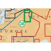
NA-M026 C-Card Format Great Lakes and The Maritimes
-
PiranhaMAX 160 - Fishfinder - portable - included transducer : XPT-9-20-T - dual-beam
-
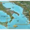
BlueChart g2 Vision - Adriatic Sea, South Coast - Maps
-
Lake Champlain Fishing North - Waterproof Charts
-
CF/38XG XL9 38XG - Moscow Area CF Card
-
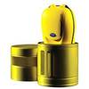
85-754A Dive Canister
-
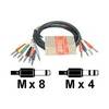
STP 803 - Audio cable kit - Male Phone stereo 6.3 mm to M Phone mono 6.3 mm
-
Simnet Cable 2m 24005837-SimNet
-
033463-10 1/4 NPT Chrome Plated Brass Tank CONN. Male
-
Whisper 70' Guyed Tower Kit (Whisper 500) (does Not Include Pipe & Anchors)
-
Inc ETS014616912 Computer Hardware