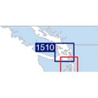
Waterproof Chart Kit - San Juan Islands #WPB1510-02
Model: WPB1510-02 Brand: Maptech
Waterproof Charts w/ Companion CD WPB1510 1510: San Juan Islands Whidbey Island and Bellingham to Boundary Pass. 23 pages of charts, 130 GPS waypoints, Lat. /Long. grids, courses, ramps, and marine facilities. Overview and detailed pass and harbor charts. 12 x 17, scales 1:200,000 to 1:20,000 Product Overview These easy-to-use, compact chart books are ideal for Day-Sailors, Fishing Boats, and Trailer Boats. They measure 12 x 17 (24 x 17 when open) and are made of waterproof, tear-resistant synthetic paper that will withstand the elements. GPS Ready New features make Waterproof Chartbooks easy to use with your GPS. Most charts include one-minute lat./long. grids to make vessel positioning a breeze, and major navigation aids are identified with named GPS waypoints. Small and Large-Scale Charts Waterproof Chartbooks include small-scale, wide area charts as well as large-scale, detailed charts of ha « less
Product Specification
-
Universal Product Identifiers
Part Number: WPB1510-02
Related Products
-
AP35-19 Autopilot with AP35, J300X, Rudder Feedback RF300, HPU-200 sap3519
-
E Series: E80/E120 Radar [DVD]
-
010-C0763-10 Bluechart G2 HEU004RIrish Sea Data Card
-
NA-C301 C-Card Format Passamaquoddy NARRAGAN
-
T70052 E125 Multifunction Display w/European Charts
-
NT+ Olympia, Wa - Port McNeill, BC NA-C701
-
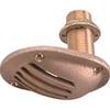
0065DP4PLB 1/2 Scoop Thru Hull w/Nut
-
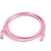
7ft 24AWG Cat5e 350MHz UTP Bare Copper Ethernet Network Cable - Pink
-
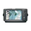
900 Series 955c - Marine Chartplotter - 8" color - 800 x 480 - widescreen
-
Filters 85-1350 Vent Kit Marine, 1/2 Flange
-
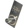
19811 PL259 with Adapter
-
n�vi 2300 - Automotive GPS receiver - 4.3" color - 480 x 272