010-C0763-10 Bluechart G2 HEU004RIrish Sea Data Card
Model: 010-C0763-10 Brand: Garmin
British coast: covers from Port Ellen on the Isle of Islay to Falmouth, including the Isle of Man and the Isles of Scilly. Irish coast: covers from Sheep Haven to Caherciveen, Republic of Ireland, including Londonderry, The Storks, Belfast, and Dublin. See your surroundings more clearly with BlueChart g2 data. With BlueChart g2, you'll get detailed marine cartography that provides convenient viewing of nautical content. BlueChart g2 allows you to see your vessel's precise, on-chart position in relation to naviads, coastal features, anchorages, obstructions, waterways, restricted areas and more. You will also have access to detailed mapping capabilities that include Safety Shading , Fishing Charts , smooth data transition between zoom levels, harmonious transition across chart borders, and reduction of chart discontinuities. « less
Product Specification
-
Universal Product Identifiers
Part Numbers: 010-C0763-10, 10804839, 35599GTIN: 00753759091491
Related Products
-
GPS receiver marine swivel mounting bracket
-
PAPR06; Region 6 Paper Chart Kit
-
SP110RF-3 System with Rudder Feedback and Type S Mechanical Das
-
PC Planner for Max Chart without Memory Card c15300
-
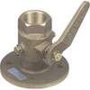
1-1 2 in. Seacock Ball Valve Bronze Made in The USA
-
Cal June/Jim-Buoy 101W White Vinyl Buoyant Boat Throw Cushions USCG Approved Type IV-
-
332037 LED Starboard Side Mount White
-
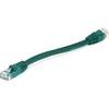
Green Six Inch Category 5 Enhanced Cat 5e Ethernet Network Cable .5
-
Bulk cable - CAT 5e - Shielded twisted pair (STP) 1000 ft - Gray
-
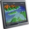
G170 17 Inch Ultra Bright Marine Display E02036
-
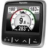
E22172 i70 Multifunction Instrument Display
-
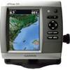
GPSMAP 526s - Marine Chartplotter - 5" color - 480 x 640