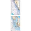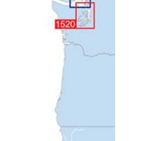
Waterproof Chart Kit - Puget Sound #WPB1520-02
Model: WPB1520-02 Brand: Maptech
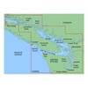
Waterproof Charts w/ Companion CD WPB1520 1520: Puget Sound Covers the entire sound from Olympia to Admiralty Inlet, including Lake Washington. 25 pages of charts, 150 GPS waypoints, Lat. /Long. grids, courses, ramps, and 180 marine facilities. Overview and detailed charts. 12 x 17, scales 1:225,000 to 1:13,000. Product Overview These easy-to-use, compact chart books are ideal for Day-Sailors, Fishing Boats, and Trailer Boats. They measure 12 x 17 (24 x 17 when open) and are made of waterproof, tear-resistant synthetic paper that will withstand the elements. GPS Ready New features make Waterproof Chartbooks easy to use with your GPS. Most charts include one-minute lat./long. grids to make vessel positioning a breeze, and major navigation aids are identified with named GPS waypoints. Small and Large-Scale Charts Waterproof Chartbooks include small-scale, wide area charts as well as large-scale, d « less
Product Specification
-
Universal Product Identifiers
Part Number: WPB1520-02
Related Products
-
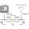
DSM250 Basic GPS with Display & Cable Black Pkg-13B
-
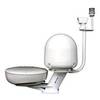
Dual Mount for Radar Dome and Satdome Combo #PMA-DM1
-
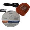
PC Planner NT 128KB for Raymarine
-
MapSource BlueChart - Puget Sound to Port Hardy - Maps
-
Waterproof Charts 15F Southwest Florida FISH/DIVE
-
WPC007; Bstn HBR to York Me Ed 4
-
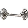
Cabin Door Hook, Bronze, 1-1/2"
-
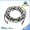
14ft 24AWG Cat6 500mhz Crossover Ethernet Bare Copper Network Cable - Gray
-
PHF1 Female Phone Connector
-
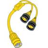
150AY Y Adapter, 2-15 20 Amp Straight Blade to 30 Amp Locking
-
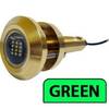
Lumishore Thru Hull Flush Fit 18 Watt Green Underwater Light 41681
-
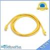
YETP5E-7 7ft 24AWG Cat5e 350MHz UTP Bare Copper Ethernet Network Cable - Yellow