Marine Navigation: Celestial and electronic [Book]
Product Specification
-
Authors: Richard R. HobbsPages: 322Format: hardbackPublication Date: December 1, 1974Key Terms: celestial navigation, Nautical Almanac, celestial horizon, celestial sphere, sky wave, Polaris, Canopus, U.S. Navy, latitude, longitude, fathometer, Loran, celestial equator, Decca, Corr, NAVSAT, Greenwich meridian, interpolation, slave station, Starfinder
-
Universal Product Identifiers
ISBN: 0870213652GTIN: 09780870213656
Related Products
-
E70022 E97 Multifunction Display W Sonar - No Charts
-
1734C NavNet vx2 Radar System
-
North Shore Long Island Sound, New Rochelle, New York to Norwalk, Connecticut Nautical Marine Charts, Large Print - Waterproof Charts
-
Inc MSD/PREM-N6 Map, HotMaps Premium North
-
UM625C-BK VHF Marine Two-Way Radio Black
-
75ft 24AWG Cat5e 350MHz UTP Ethernet Bare Copper Network
-
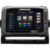
00010778001 HDS-7 Touch G2 Insight W-Lss
-
Cable Ci 14-2 W PB500 Contractor 14-Gauge Speaker
-
3ft 28AWG DVI-A to SVGA (HD15) Cable - Black
-
Ethernet Category 6 Enhanced RJ45 Network Patch Cable - 14' Black.
-
24006199 - Adapter, Simnet to N2K Micro-C (Female)
-
Wiring Device-Kellems HBL61CM65 Receptacle,marine,20 A 3d236