010-C0747-10 Bluechart G2 HAF001REastern Africa Data Card
Model: 010-C0747-10 Brand: Garmin
General coverage of the east coast of Africa from the Gulf of Tadjoura to the Bay of Maputo, including Mogadishu, Som., Mombasa, Ken., and Dar es Salaam, Tan. Also includes general coverage of the entire coast of Madagascar. Includes detailed coverage of Djibouti, Dji., Maputo, Moz., Mauritius, Reunion, and the Seychelles. See your surroundings more clearly with BlueChart g2 data. With BlueChart g2, you'll get detailed marine cartography that provides convenient viewing of nautical content. BlueChart g2 allows you to see your vessel's precise, on-chart position in relation to naviads, coastal features, anchorages, obstructions, waterways, restricted areas and more. You will also have access to detailed mapping capabilities that include Safety Shading , Fishing Charts , smooth data transition between zoom levels, harmonious transition across chart borders, and reduction of chart discontinuities. « less
Product Specification
-
Universal Product Identifiers
Part Numbers: 010-C0747-10, 10804532, 35575GTIN: 00753759089634
Related Products
-
AP50 Autopilot with AP50, J50-40 (40 Amps), Rudder Feedback RF300
-
NA-M033 C-Card Format - Atlantic Coast Gulf Caribbean
-
000-10041-001 Nautic Insight HD US Coastal East
-
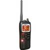
MHS125 Handheld Two-Way VHF Marine Radio
-
611 Marine Navigation Compass Nickel 7-inch
-
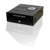
Marinenav Leviathan Marine Navigation PC Computer LEV-017R-Intel
-
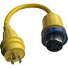
A50H30S 125/250VAC - 50 Amp -to- 125VAC - 30 Amp Straig
-
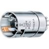
HBL63CM65 Male Plug 50A 125/250V Ship-to-Shore
-
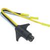
Trolling Motor CONNECTOR, Male, Motor Side #7647-7
-
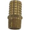
18-4461 Brass Connector
-
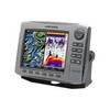
HDS-8 - Marine Chartplotter - 8" color - 800 x 600
-
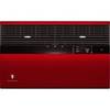
KWREDS Designer Colored Front for Sleeve Type S: Deep Red