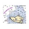
NA-M033 C-Card Format - Atlantic Coast Gulf Caribbean
Model: NA-M033 Brand: C-Map
NA-M033 => Atlantic Coast, Gulf of Mexico and Caribbean Coverage includes most of the eastern coastline of North America. Lawrence and Nova Scotia. The St. Lawrence River is covered down to Montreal. The Gulf of Mexico, from Key West, FL to Brownsville, TX is covered in its entirety. All the islands of the Caribbean are covered, from the Bahamas over t « less
Product Specification
-
Universal Product Identifiers
Part Number: NA-M033C-CARDGTIN: 00686074002883
Related Products
-
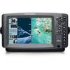
958c HD Di Down Imaging GPS Fishfinder 408710-1 c46192
-
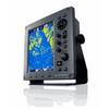
JMA-3316HS Radar 6KW 72 nm, 3.9 ft Open Array with 27-48 rpm Radar Antenna
-
Inc MSD/652P Map, Lake Huron
-
ChartKit Book w/ Companion CD - Southern and Centra Map
-
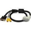
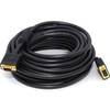
010-11091-00 Marine Audio/Video Cable, Right Angle
-
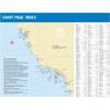
Puget Sound (Small Craft) Chart
-
Marine World Chart of Nicolo de Canerio Januensis, Circa 1502: A Critical Study (1908) [Book]
-
FBRS 2775 Battery Serive Includes 1096 Batt Parts Labor
-
Cat6a Ethernet Cable | 15ft | Gray | Network | 10 Gigabit
-
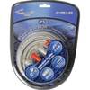
Audiopipe Ip2rca25 2 Ch Marine Oxygen Free RCA Cable 25 ft 2 Channel
-
VGA Male to Male Cable 35 ft. CL2
-
Marine Products Plug Wire Set, Mercruiser V-8, 9-28000