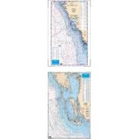
Waterproof Charts 15F Southwest Florida FISH/DIVE
Model: 15F Brand:
15F SOUTHWEST FLORIDA FISH/DIVEComplete offshore coverage from Tampa Bay south to 50 Miles South of Marco Island. Reverse side is coastal coverage from Englewood south to Ft. Myers Beach with complete depths for Charlotte Harbor, Pine Island Sound and Matlacha Pass. A table recompiled in FALL of 1999 contains a total of 209 Plotted and Indexed GPS/LORAN WAYPOINTS for Reefs and Wrecks, Lights and Fishing and Diving Areas. Information from 2 NOAA Charts; 11426 & 11420.25 x 38 « less
Product Specification
-
Universal Product Identifiers
Part Number: 15F
Related Products
-
010-00958-00 - GSD 26 Sounder Module 3KW Chirp
-
010-11094-00 NMEA 2K Male Connector
-
E70014 C127 Multifunction Display w/Sonar - No Preloaded Cha
-
3204 Lake Havasu
-
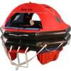
MD3-6S Life Raft 6 Person Soft Valise
-
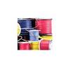
6/3 50 Amp, 125 Volt Cable, 250' Spool, Yellow 14180
-
332037 LED Starboard Side Mount White
-
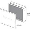
Suncovers for G Series Marine Displays G120 9717638
-
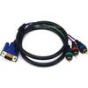
3ft VGA to 3 RCA Component Video Cable (HD15 - 3-rca)
-
da-da572 Mini-UHF Male to TNC Female Adapter
-
Marine Products Plug Wire Set 9-28055
-
E62355 - e7D, 7 GPS/MFD/Sonar w/o Charts