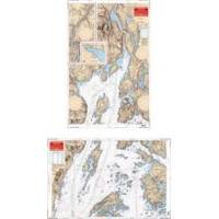
Rockport to Bangor, Maine Nautical Marine Charts - Waterproof Charts
Designed for recreational boaters, fishermen and divers. Waterproof Charts are beautifully printed on synthetic paper. For use on deck in any weather rain or spray! Accurate, used by Coast Guard and Navy, simple to use with GPS. Foldable and easy to hold and store Waterproof Charts are so tear resistant you can't ruin them. Printed on both sides so they save you money! This great chart combines 2 NOAA charts for coverage of this popular boating area. Starting in Bangor covers the Penobscot River downstream thru Bucksport to Searsport then broadens to cover Penobscot Bay, Belfast, Castine and Islesboro Island. An inset gives details of Belfast Harbor and east across the bay the coverage continues to Castine Harbor, Smith Cove and the Bagaduce River up to Northern Bay. Twenty two GPS waypoints make it easy to set up your GPS for navigating this area. Information from 2 NOAA charts 13309 and 13305. GPS datum. « less
Product Specification
-
Universal Product Identifiers
Part Number: 106
Related Products
-
HDS-5 Gen2 Nautic Insight w/o Transducer CW42971
-
010-C0924-10 Bluechart G2 HAW005RThe Gulf & Red Sea Data Card
-
NOAA Dixon Entrance-Cape St. Elias
-
Canadian Charts Sunshine Coast
-
Marine Navigation: Celestial and electronic [Book]
-
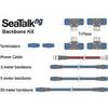
A25062 SeaTalkNG Backbone Cable Kit for ST70
-
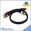
1.5ft Premium 2 RCA Plug/2 RCA Plug M/M 22AWG Cable - Black
-
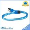
24inch SATA 6Gbps Cable w/Locking Latch - UV Blue
-
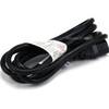
6ft 16AWG Power Cord Cable w/ 3 Conductor PC Power Connector Socket (C13/5-15P) - Black
-
000-10290-001 - NSO System, Processor Only
-
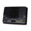
MFDBB NavNet 3D Black Box Multi Function Display Processor
-
Marine Products Plug Wire Set 9-28048