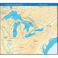
NT+ Wide Map, Mississippi and Illinois Rivers
Model: Brand: C-Map
C-MAP has set the standard for electronic charts with five consecutive NMEA awards for "Best Electronic Cartography". Built on the incredible success of C-MAP NT+, NT+ Wide combines a generation of chartplotters with efficient performance plus real-time accuracy and detail. Now you will be able to see slip detail as well as the locations for onshore facilities. « less
Product Specification
-
Universal Product Identifiers
Part Number: NA-C040GTIN: 00686074004016
Related Products
-
AP35-3 Autopilot with AP35, J300X-40(20A peak), Rudder Feedback RF300 sap35-3
-
010-C0764-10 Bluechart G2 HEU005RIreland West Coast Data Card
-
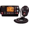
MR-F80B-D Rewind-Say-Again VHF Radio
-
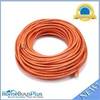
100ft 24AWG Cat6 550mhz UTP Ethernet Bare Copper Network Cable - Orange
-
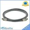
6ft Premium Optical Toslink Cable w/ Metal Fancy Connector
-
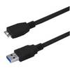
USB 3.0 Micro Cable | 10ft | Type A | Micro Type B | Black
-
Filters 85-1350 Vent Kit Marine, 1/2 Flange
-
T-H Marine TH7592B; 3/4 90 Degree Thru-Hull White Fitting
-
/ Quicksilver 864182T Connector Pnla
-
5 Inch Power Mount Forward Lean Universal Mount with Light Bracket Option PMF-5U-7L (PMF-57-M1 + ADA-R1) wpmf5u7l
-
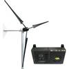
Whisper Marine Wind Turbine Whi-200 Marine with Controller
-
FCF000119A Teak Fresh Air Vent Kit for 12,000 / 16,000 BTU Units