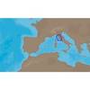
010-C0764-10 Bluechart G2 HEU005RIreland West Coast Data Card
Model: 010-C0764-10 Brand: Garmin
Detailed coverage of the west coast of Ireland from Cork Harbour to Belfast. Also covers the Scottish coast from the Isle of Colonsay to Campbeltown Harbour. See your surroundings more clearly with BlueChart g2 data. With BlueChart g2, you'll get detailed marine cartography that provides convenient viewing of nautical content. BlueChart g2 allows you to see your vessel's precise, on-chart position in relation to naviads, coastal features, anchorages, obstructions, waterways, restricted areas and more. You will also have access to detailed mapping capabilities that include Safety Shading , Fishing Charts , smooth data transition between zoom levels, harmonious transition across chart borders, and reduction of chart discontinuities. « less
Product Specification
-
Universal Product Identifiers
Part Numbers: 010-C0764-10, 10804854, 35601GTIN: 00753759091514
Related Products
-
E12199 SmartPilot X-30 SmartPilot Corepack
-
Marine Pollution Including Ocean Acidification, Eutrophication, Marine Debris, Mercury in Fish, and Active Sonar [Book]
-
JMA-5110 Radar 72NM with 10KW 6 Foot Open Array & 10 Inch Color LCD Display
-
EM-C950 C-Card Format - Marina Di Carrara
-
TS200-30 Temperature Probe f/SST-110 Thru-Hull
-
E12206 Smartpilot X-5 Sportpilot
-
Series 50 Classic Stainless Steel Navigation Lights
-
HDMI to Micro HDMI Cable, High Speed with Ethernet, 15 ft
-
500ft 12AWG CL2 Rated 2-Conductor Loud Speaker Cable (for In-Wall Installation)
-
Whisper 80' Guyed Tower Kit (Whi100/Whi200) (does Not Include Pipe & Anchors)
-
AISnet Network
-
America AT-140 Tuner