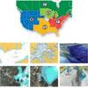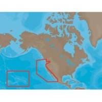
NA-M024 SD Card Format US West Coast and Haw
Model: NA-M024 Brand: C-Map
NA-M024 => USA West Coast and HawaiiCoverage of the Pacific Coast of the United States, including all of the coasts of California, Oregon and Washington. Coverage of Baja California and Mexico down to Puerto Vallarta. Detail of the Columbia River, Sacramento River, Willamette River. Snake River and San Joaquin Rivers are also included. Full coverage of Puget Sound and the San Juan Islands up to Point Roberts is also included. Additional coverage of the Hawaiian Islands out to Midway and Johnston Atoll is also included. « less
Product Specification
-
Universal Product Identifiers
Part Numbers: 30147, CMANAM024SD, M-NA-M024, NA-M024-SD, NA-M024SDCARDGTIN: 000000165847, 00686074002746
Related Products
-
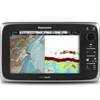
E70022 E97 Multifunction Display W Sonar - No Charts
-
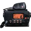
Quest 1500s VHF - Marine Radio
-
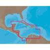
NA-C502 Furuno FP Format Western Caribbean S
-
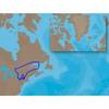
NA-C202 Furuno FP Format - St. Lawrence Rideau Champlain
-
37637 HotMaps Platinum Multi-Dimensional 3D Lake Maps
-
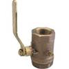
Inline Valve, 1 Inch Pipe
-
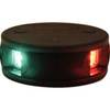
LED Bicolor Light Black 12V
-
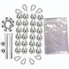
Whisper 30' Guyed Tower Kit (Whi100/Whi200) (does Not Include Pipe & Anchors)
-
7ft 24AWG Cat6 550mhz UTP Ethernet Bare Copper Network Cable - Purple
-
1ft 24AWG Cat6 550mhz UTP Ethernet Bare Copper Network Cable - Red
-
GlobalMap 5300C iGPS - Marine GPS receiver - 5" color - 480 x 480
-
Earthmate GPS PN-60w - Hiking GPS receiver - Color