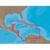
NA-C502 Furuno FP Format Western Caribbean S
Model: NA-C502 Brand: C-Map
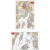
NA-M320 => Passamaquoddy Bay to Cape LookoutCoverage includes offshore bathymetric details from Passamaquoddy Bay, ME to Cape Lookout, NC. Coverage extends from the coastline out to the Atlantic Canyons - Hudson, Baltimore, Oceanographer and others. Fishing Contour Charts do not include coastal navigational features and are recommended for offshore fishing only. « less
Product Specification
-
Universal Product Identifiers
Part Numbers: 20172, 31356, CMANAC502FP, NA-C502, NA-C502FURUNOFP, NA-M320-SD, NA-M320SDCARDGTIN: 00686074003835
Related Products
-
E62188-US - A57D 5.7 Combo, Coastal Maps, Int GPS
-
GMR24 HD Radar 24 Inch 4KW 48NM Range High Definition Dome with 15 Meter Cable 010-00572-03
-
Rockport to Bangor, Maine Nautical Marine Charts - Waterproof Charts
-
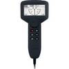
Ite-unnum415bk-ptrind1 Um415Oceanus D Marine Radio
-
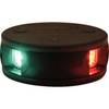
LED Bicolor Light White 12V/24V ASL-341017
-
NAVPILOT 720 Autopilot HH Inboards No Pump
-
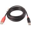
ZDIGWLEXT USB Self Powered Extension Cable WL400/500
-
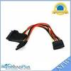
5184 0.2meter 15pin SATA Power Y Cable
-
Patch cable - CAT 5e - RJ-45 - M - Unshielded twisted pair (UTP) 50 ft - Gray
-
50ft Super VGA M/F CL2 Rated (for In-Wall Installation) Cable w/ Ferrites (Gold Plated)
-
Marine -9-72652 PLUG,DRAIN - Magnet
-
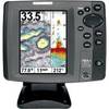
700 Series 787c2 Combo - Marine Chartplotter - 5" color - 640 x 480