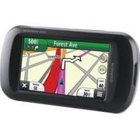
Montana 650t Handheld GPS 41813
Model: 650t Brand: Garmin
Take it hiking. Take it hunting. Take it on the water. Montana 650t features a bold 4 in. color touchscreen dual orientation display and TOPO U.S. 100K maps, supports multiple mapping options like Birds - Eye Satellite Imagery and it has a 5 megapixel camera to boot. Montana has key features for the outdoors such as a 3-axis tilt-compensated compass and barometric altimeter. Buy the auto mount and a City Navigator NT map, and it'll give you spoken turn-by-turn driving directions. It's big. It's versatile. It's tough. It earned the name Montana - the ultimate in touchscreen toughness. Its easy-to-use interface means youll spend more time enjoying the outdoors and less time searching for information. Both durable and waterproof, Montana 650t is built to withstand the elements. Bumps, dust, dirt, humidity and water are no match for this rugged navigator. No matter the setting on the boat, in the RV or on an ATV Montana is right at home. Take Geotagged Pictures Capture locations and memories with Montana 650ts 5 megapixel digital camera. Each photo is geotagged automatically with the location of where it was taken, allowing you to navigate back to that exact spot in the future. Snap and view pictures in landscape or portrait orientation. To keep track of your photos and show their location on a map, simply connect Montana 650t via USB and use Garmins free Base - Camp software. For more storage, insert a micro - SD card; you can even view pictures from other devices on micro - SD with Montana's picture viewer. Go Anywhere With an array of compatible mounts, Montana 650t is designed for use on ATV? s, in boats, as a handheld or in your car as a personal navigator. Use the auto mount with City Navigator maps for spoken, turn-by-turn driving directions, or the rugged mount for your motorcycle or ATV. Wherever you think you might take Montana, it has the mapping and mounts to get you there. Go Everywhere Adding more maps is easy with Garmin's wide array of detailed topographic, marine and road maps. With its micro - SD card slot, Montana 650t lets you load TOPO U.S. 24K maps and hit the trail, plug in Blue - Montana 650t also supports Birds - Eye Satellite Imagery (subscription required), that lets you download satellite images to your device and integrate them with your maps. In addition, Montana is compatible with Custom Maps , free software that transforms paper and electronic maps into downloadable maps for your device. Share Wirelessly With Montana 650t you can share your waypoints, tracks, routes and geocaches wirelessly with other compatible Garmin GPS users. So now your friends also can enjoy your favorite hike or cache simply press send? to transfer your information to similar units, and let the games begin. Keep Your Fix With its high-sensitivity, WAAS-enabled GPS receiver and Hot - Fix satellite prediction, Montana 650t locates your position quickly and precisely and maintains its GPS location even in heavy cover and deep canyons. Double Your Power Montana 650t features a one-of-a-kind dual battery system. Youll have the option of using the rechargeable lithium-ion pack or traditional AA batteries whichever suits your needs better. Find Fun Montana 650t supports geocaching GPX files for downloading geocaches and details straight to your unit. - Caching.com to start your geocaching adventure. By going paperless, you're not only helping the environment but also improving efficiency. Simply upload the GPX file to your unit and start hunting for caches. Physical & Performance: Unit dimensions, WxHxD: 2.9" x 5.7" x 1.4" (7.48 x 14.42 x 3.64 cm) Display size, Wx - H: 2"W x 3.5"H (5.06 x 8.93 cm); 4" diag (10.2 cm) Display resolution, Wx « less
Product Specification
-
Universal Product Identifiers
Part Number: 41813
Related Products
-
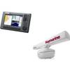
SIMKIT-2 Autopilot Install Kit
-
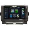
NX40 8.4" Display Built in Sounder with GPS Antenna
-
A67 Mfd Touchscreen W/built-in Digital Sonar - Navioni Map
-
Radar 25M Split Power Pedestal Cable-Radar
-
Package(C90W, RA1072HD 4KW 72 Inch HD Digital Open Array Radar & 15m Radar Cable)
-
Inc MSD/652P Map, Lake Huron
-
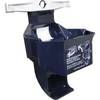
9502 Low Pro 3 Cat II EPIRB Mounting Bracket
-
00010771001 HDS-9 Touch G2 Insight 83/200
-
Chartwork and marine navigation for fishermen and boat operators [Book]
-
6ft 24AWG CL2 High Speed HDMI Cable Male to Female Extension - Black
-
12ft 18AWG CL2 Premium 3-RCA Component Video Coaxial Cable
-
900 Series 997c SI Combo NVB - Marine Chartplotter - 8" color - 800 x 480 - widescreen