Max Mega Wide International cmegai
Model: Brand: C-Map
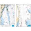
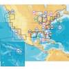
Dynamic tides and currents predict the time, level, direction and strength of currents and tides. Guardian Alarm performs an automatic forward-scanning check for obstacles. Use this feature as an added backup to alert you if you head toward a potentially harmful object. Photos and diagrams in high-definition of ports, marinas and significant navigational marks will help you to familiarize yourself with new destinations and passages. Route-check is an extension of Guardian Alarm, helping keep you safe by indicating obstacles along the segments between waypoints. Depths and land elevation show the usual depth information and the colors make it easy to distinguish different water depths and land elevations. Detailed harbor charts so docking in unfamiliar ports is no problem. You have precise layouts of thousands of marinas, including slip spaces, restricted areas and other valuable navigation information. Perspective view gives a bird's-eye view of your navigation area, it tilts the chart view to a 45-degree angle. C-Marina Port Database has details on more marinas than other charts on the market. Multi-language capability All C-MAP by Jeppesen charts can be displayed in both English and the local language of each region. « less
Product Specification
-
Universal Product Identifiers
Part Number: cmegai
Related Products
-
eTrex H - iking GPS receiver - Monochrome - 64 x 128
-
T70035 C127 Multifunction Display w/Sonar - Row Charts
-
Digital Guages LST-3800 - Depth sounder - included transducer : Skimmer
-
T70054 E125 Multifunction Display w/ROW Charts
-
Waterproof Charts 123F Coastal Miami Trolling Chart - FISH/DIVE
-
CF/637P+ NJ & Deleware Plat+ on CF
-
CF/38XG XL9 38XG - Moscow Area CF Card
-
High Performance Marine Heading Sensor NMEA 0183 Cable
-
Series 41 Navigation Lights White Housing, Port Side Mount
-
Serial cable - (DB-9) - M - 15 ft - PC
-
MR HH125 VHF 16-channel Two-way radio
-
Wiring Devices HBL23CM13 CONNECTOR, AC Power, Plug, 20A, 125V