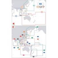
Max Chart for New Zealand in SD Format, M-AU-M001
Model: M-AU-M001 Brand: C-Map
Coverage of New Zealand and Pacific Island's cover's Campbell Island - Cooke Strait - Lake Taupo - New Plymouth - Whangaroa Harbour - West Samoa - Phoenix Island - Papeete,French Polynesia and Cook Island's
Product Specification
-
Universal Product Identifiers
Part Number: AU-M001
Related Products
-
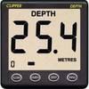
CL-D Depth Instrument with Thru Hull Transducer & Cover
-
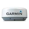
29035 GMR 18 / 4 KW Digital Marine Radar Scanner
-
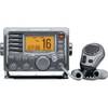
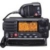
m504a-63 Submersible Plus Class D DSC VHF Marine Radio Gray
-
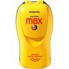
Fastfinder 406 Max-G Personal Locating Beacon 10-85-890-001A
-
010-C0760-10 Bluechart G2 HEU001REnglish Channel Data Card
-
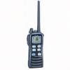
GX2100SB Two-Way Radio, Marine, 25 Watts
-
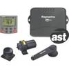
E12120 SmartPilot S1 S1G System Packs, Auto Pilot s1g/st6002 Inboard Ray
-
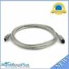
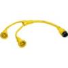
9 Pin/ 6pin Bilingual FireWire 800 - FireWire 400 Cable, 6ft, Clear
-
M72 220V Charger Euro with BC-147E
-
HBL64CM57 Y Adapter 2 30A Cords - 50A 125V Dock
-
16 Inch Aft Power Mount Simrad Light Bracket Option PMA-16N-7L (PMA-167-M1 + ADA-R1)
-
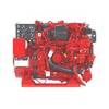
5.5 BCD Diesel Generator