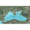
010-C0760-10 Bluechart G2 HEU001REnglish Channel Data Card
Model: 010-C0760-10 Brand: Garmin
British coast: covers from Felixstowe to the Isles of Scilly, including Dover, The Solent, and the Isle of Wight. Also covers the River Thames from Twickenham to the North Sea. French coast: covers from Dunkerque to L'Aber Wrac'h, including Rouen and the Channel Islands. See your surroundings more clearly with BlueChart g2 data. With BlueChart g2, you'll get detailed marine cartography that provides convenient viewing of nautical content. BlueChart g2 allows you to see your vessel's precise, on-chart position in relation to naviads, coastal features, anchorages, obstructions, waterways, restricted areas and more. You will also have access to detailed mapping capabilities that include Safety Shading , Fishing Charts , smooth data transition between zoom levels, harmonious transition across chart borders, and reduction of chart discontinuities. « less
Product Specification
-
Universal Product Identifiers
Part Numbers: 010-C0760-10, 10804748, 35593GTIN: 00753759091439
Related Products
-
010-C0924-20 Bluechart G2 HXAW005RThe Gulf & Red Sea Microsd/sd
-
010-C1064-20 G2 HXRU002R Black Sea & Azov Bluechart SD
-
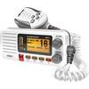
Oceanus D UM415 Fixed Mount Submersible VHF Marine Radio
-
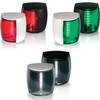
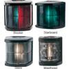
Marine Naviled Pro Port Navigation Light
-
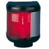
40300-7 S40 Port Navigation Light 12v/25w
-
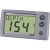
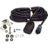
E22044 ST-40 Depth w/Thru Hull Transducer
-
Marine 2 NM Stern Lamp
-
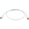
3ft 28AWG DisplayPort Cable - White
-
HST-WSBL Transom Mount Depth/Temp Transducer Blue Connector 106-72 whstwsbl
-
E55058 Seatalk HS Network Switch
-
1ft 24AWG Cat6 550mhz UTP Ethernet Bare Copper Network Cable - Green
-
AIS Network Dual Channel Rcvr w/GPS