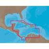
MapSource BlueChart - Southeast Florida - Maps
Model: Brand: Garmin
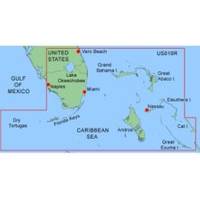
MapSource BlueChart is Garmin's exclusive marine cartography and was developed to provide you with mapping flexibility and options you've never had before. This line of cartography products is designed to provide interactive viewing of detailed nautical chart data, thereby providing navigators with innovative object-oriented cartography. These detailed electronic nautical charts look just like paper charts when displayed on your Garmin chartplotter. Features include shading between depth contours, spot soundings, navaids, port plans, wrecks, obstructions, inter-tidal zones, and more. BlueChart offers much larger coverage areas for half the price. MapSource BlueChart Southeast Florida covers Vero Beach south to include Lake Okeechobee, Florida Keys, Dry Tortugas, and covering the west coast of Florida north to Naples. Also covered all the Bahamas, Andros Island, Eleuthera Island, Cat Island, Great Exuma Island, Little Exuma Island, and Hog Cay. It features data from explorer charts for the Bahamas. « less
Product Specification
-
General
Product Type: MapsDistribution Media: Garmin Data CardFirst Seen On Google Shopping: January 2006 -
Compatibility Information
Designed For: Garmin GPSMap 172C, 176, 176C, 178C, 178C Sounder, 182, 182C, 188 Sounder, 188C Sounder, 196, 2006, 2006C, 2010, 2010C, 2106C, 2110C, 2206C, 2210C, 232, 238 Sounder, 276C, 292C, 296, 298C, 3006C, 3010c, 3205C, 3206C, 3210C, 376C, 392C, 396C, 492C, 498C -
Universal Product Identifiers
Part Numbers: 010-C0024-00, Southeast FloridaGTIN: 00673493492432, 00753759031718
Related Products
-
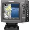
788ci HD Di Combo Down Imaging Combo 39704
-
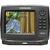
HDS-7 Gen2 Fishfinder GPS Chartplotter 53518700
-
T70027 C97 Multifunction Display w/Sonar - US Inland Charts
-
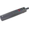
ST1000 Plus Tiller Autopilot Tiller Autopilot St2000+ A1200
-
NA-C502 Furuno FP Format Western Caribbean S
-
700 Series 718 - Fishfinder - included transducer : XNT-9-20-T - dual-beam
-
E12205 X-Sol Corepack Use with Solenoid Drive Systems
-
DVI or VGA Interconnect Cable to (digital) 10M
-
10gb Fiber Optic Cable, LC/LC, Multi Mode, Duplex - 1 Meter
-
A62246 - Seatalk Hs Dual End Network Cable 15m
-
409050-1 386ci Di Combo
-
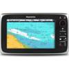
700 Series 785c2 - Marine Chartplotter - 5" color - 480 x 640