Inc MSD/649P Map, Lake Erie & Saint Clair
Model: 649P Brand: Navionics
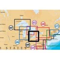
Navionics 649P+ Lake Ontario Platinum+ Multi-Dimensional Charts, with the most advanced technology and best imaging available, provide high-resolution photo/chart overlay, full-view XGA panoramic pictures, improved 3D view, complete geo-referenced coast pilots. Compatibility Guide
Product Specification
-
Universal Product Identifiers
Part Numbers: 11093846, 37652, 649P+, DEF-257881MSD649, MSD-649P-, MSD649P+, SD649P, SD/649P+GTIN: '82124564959, 00821245649591
Related Products
-
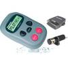
S1000 Autopilot Wireless 8.5 Max Ram 12169
-
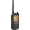
Mrhh 425li VP Marine VHF Transceiver with All-Terrain Radio
-
010-C1025-20 Bluechart G2 HXEU718LMediterranean Sea Microsd/sd
-
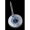
Nickel Compass Chart Weight & Pen Set
-
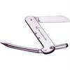
1550 Knife Rigging Standard S/S
-
41320-1 S41 Port Navigation Light 24V, Black
-
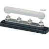
2303 Busbar 4x1/4in Stud Common Bu
-
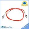
Fiber Optic Cable, LC/LC, Multi Mode, Duplex - 1 Meter 6202
-
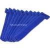
Hook & Loop Fastening Cable Ties 6inch, 10pcs/Pack - Blue
-
150AY Y Adapter, 2-15 20 Amp Straight Blade to 30 Amp Locking
-
Product FCF0016000GS Air Conditioner 115V FCF16000
-
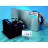
Barbour Air Cooled Power Plate PB100134