How To Read a Nautical Chart: A Captain's Quick Guide [Book]
Your quick-reference, on-board guide to the symbology and shorthand notations used on nautical charts Nautical charts contain an incredible amount of information for those who know how to decipher them. But without a key to the symbology, a chart can be bewildering. Nigel Calder, one of today's most respected boating authors, helps you make sense complex system of signs, symbols, and graphic elements with this compact, waterproof, and nearly indestructible guide. « less
Product Specification
-
Authors: Nigel CalderPages: 16Format: paperbackPublication Date: November 11, 2008Key Terms: nautical chart, Chesapeake Bay, cardinal marks, navaids, nautical mile, Penobscot Bay, true north, day beacon, swing bridge, vector chart, NOAA chart, electronic charts, Hydrographic Office, lighthouse, magnetic north, raster chart, Kelp, spring tides, Occulting, paper charts
-
Universal Product Identifiers
ISBN: 0071592873GTIN: 09780071592871
Related Products
-
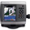
GPSMAP 441s GPS Combo T/M D/F Reman Noh
-
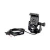
GPS receiver marine mount bracket
-
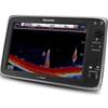
E127 Multifunction Display with Sonar - European Charts T70053 c44356
-
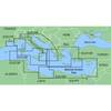
MapSource BlueChart - Italy, Adriatic Sea - Maps
-
Hydrographical Surveying; A Description of Means and Methods Employed in Constructing Marine Charts [Book]
-
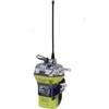
2848 Globalfix iPro Cat II EPIRB with GPS (Manual Activation)
-
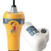
700S-00767 SafeSea E100G GPS EPIRB Category 1 - Auto Rele
-
EC04110 Blue 16-14 Butt Connector PK10
-
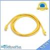
YETP5E-7 7ft 24AWG Cat5e 350MHz UTP Bare Copper Ethernet Network Cable - Yellow
-
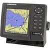
GlobalMap 5300C iGPS - Marine GPS receiver - 5" color - 480 x 480
-
AIS Network Dual Channel Rcvr w/GPS
-
GPS-90 18-Channel GPS Satellite WAAS Receiver