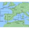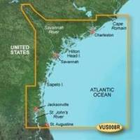
BlueChart g2 Vision - Charleston to Jacksonville - Maps
Model: Brand: Garmin
BlueChart g2 Vision offers the same rich detailed charting of BlueChart g2 to help you get the most out of your unit. In addition, g2 Vision features a growing database of high-resolution satellite imagery, above and below the water 3D perspective, auto guidance technology, aerial photographs for real world reference and coastal roads with points of interest. This product features Cape Romain through St. Augustine including Charleston, Savannah and Jacksonville with the St. John's River covered to the Clay County line. « less
Product Specification
-
General
Product Type: MapsDistribution Media: SD Memory CardFirst Seen On Google Shopping: May 2007 -
Compatibility Information
Designed For: Garmin GPSMAP 4008, 4012, 420, 4208, 420s, 4212, 430, 430s, 430sx, 430x, 440, 440s, 440sx, 440x, 450, 5008, 5012, 520, 5208, 520s, 5212, 525, 525s, 530, 530s, 535, 535s, 540, 540s, 545, 545s, 550, 550s, 555, 555s -
Universal Product Identifiers
Part Numbers: 010-C0709-00, Charleston to JacksonvilleGTIN: 00753759068899
Related Products
-
AP5011 Autopilot with AP50, J50, Rudder Feedback RF300, HLD2000L (Long Stroke)
-
536.5 Triple Tone Boat - Small
-
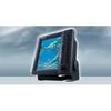
FR8252 Color 12.1 Inch LCD 25 KW 96Nm Radar with 4' Open Array
-
MapSource BlueChart - Irish Sea - Maps
-
BlueChart g2 - The Nordics - Maps
-
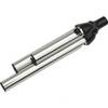
ICE 35 - Fishfinder - portable - included transducer : XI 9 19 - dual-beam
-
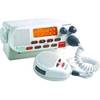
dq2955 25-Watt VHF Class D fixed-flush Mount Marine Radio
-
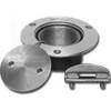
Pipe Dk Plt 1.25 PLB - Buck Algonquin
-
41500-7 Series 41 12V 10W Stern
-
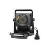
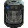
70 Allround Red Nav Light
-
Video / audio cable - Male RCA to M RCA
-
LTD A3030Y50 50 Amp to 30 Amp Y Adapter