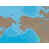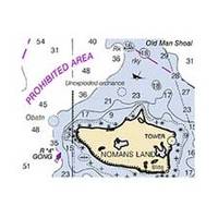
Hecate Strait-Etollin Island Chart
Dept. of Commerce - 17420; NOAA nautical charts Encompasses the southern part of Southeast Alaska Note: Ensure that your charts are kept current to reflect changes to that area
Product Specification
-
Universal Product Identifiers
Part Number: 17420
Related Products
-
121-38 LRA 1800 Radome 18" 2KW Broad
-
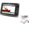
Package(c97 with USA Coastal Chart, 4KW 18 Inch Digital Radome & Radar Cable)
-
NA-C702 C-Card Format Nanoose - Victoria Cap
-
Max EN-M326 W9 Finland Lakes-MAX
-
Quatsino Sound Chart
-
Cdr10 Digital Chart Kit Pr and US VI
-
010-C1024-10 Bluechart G2 HUS401SBermuda Data Card
-
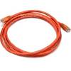
7ft 24AWG Cat6 500mhz Crossover Ethernet Bare Copper Network Cable - Orange
-
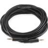
646 25ft 3.5mm Stereo Plug/Plug M/M Cable - Black
-
Lumishore THX72-CCP-FF Thru-Hull Flush Fit Color Change Underwater Lig
-
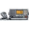
M604A VHF Radio Hailer RX Repeat Fog Horn - 30W - Grey cw-41446
-
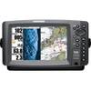
408720-1 998c HD Si Combo