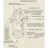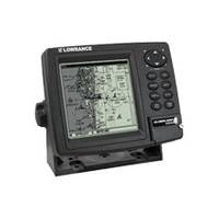
GlobalMap 4800M - Marine GPS receiver - 5" monochrome - 480 x 480
Model: 4800M Brand: Lowrance
GlobalMap 4800M is a Precision Lowrance GPS+WAAS mapping system with superb high-resolution detail for marine and automotive use. So easy-to-use. So intelligent. And so smartly affordable!
Product Specification
-
General
Product Type: GPS receiverRecommended Use: MarinePreloaded Maps: USA, HawaiiReceiver: 12 channelCard Reader: SD Memory CardInterface: NMEA 0183, NMEA 2000Compatible Software: Lowrance Fishing Hot Spots Elite, Lowrance FreedomMaps USA Topo, Lowrance LakeMaster Pro Maps, Lowrance MapCreate USA Topo, Navionics chartsSBAS: WAASAntenna: ExternalUpdate Rate: 1/secondFirst Seen On Google Shopping: August 2007 -
Display
Type: TFT - monochromeDiagonal Size: 5"Resolution: 480 x 480Display Illumination: Yes -
Navigation
Waypoints: 1000Routes: 100Waypoints per route: 10000 -
Miscellaneous
Protection: WaterproofIncluded Accessories: Protective cover -
Dimensions & Weight
Width: 6.9 inDepth: 3.4 inHeight: 5.4 in -
Manufacturer Warranty
Service & Support: 1 year warranty -
Universal Product Identifiers
Part Numbers: 117-04, 117-041, 4800MGTIN: 00042194523262
Related Products
-
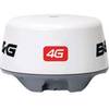
4G Broadband Radar Dome with 20m Cable c42562
-
Max Electronic Chart, Wide, South-West European Coasts, DVD, M-EM-M076
-
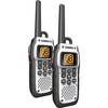
MHS050-2 VHF Submersible Two-Way Marine Radios
-
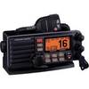
010-00756-00 VHF 300 Marine Radio
-
Standard - Gx5000S - Quantum, Hailer, Rem CON, BLUETOOTH, Blk
-
0493DP999N Cork Gasket
-
Cat6a Ethernet Cable | 3ft | Black | Network | 10 Gigabit
-
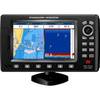
G120 Marine Display 12 Inch E62247 c31585
-
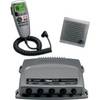
MWR150 Full Display Wired Marine Remote Control Map
-
25ft 24AWG Cat5e 350MHz UTP Bare Copper Ethernet Network Cable - White
-
Inc ETS0119746 Computer Hardware
-
CPF300I 7" GPS Chart Plotter / Fishfinder Combo