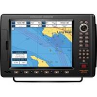
CP590 12 GPS Chartplotter w/Coastal Charts Map
Model: CP590 Brand: Standard Horizon
CP590 - WAAS GPS Chart Plotter External Antenna with built-in C-Map Cartography Find every destination in style with the CP590 WAAS enabled GPS Chart Plotter. Preloaded with detailed maps for coastal navigation of USA including Alaska, Hawaii and Great Lakes, Canada, Bahamas, Caribbean, Cuba, Mexico, Puerto Rico, and Central America. Providing up to 10-foot accuracy the CP590 is designed to navigate you quickly and accurately to your destination. The CP590 boasts a crisp high-definition 12-inch 800x600 (SVGA) sunlight viewable TFT display. The 5 user programmable hot keys allow quick and easy access to a number of preprogrammed navigation displays. Connect your CP590 to two video sources and watch your favorite DVD, play your favorite video game, or monitor your engine room in full screen or Picture in Picture. In addition, the CP590 has one VGA Video output that connects to an external TV or Monitor allowing your passengers to view the vessels progress to a favori « less
Product Specification
-
Universal Product Identifiers
Part Numbers: 40777, CP500, CP590, DEF-258647GTIN: 00788026126040
Related Products
-
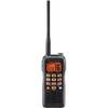
Hx850s Two-Way Radio,marine,5 Watts 4lpr5
-
Sea Charts of the British Isles: A Voyage of Discovery Around Britain & Ireland's Coastline [Book]
-
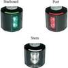
Series 43 White LED Navigation Light Stern
-
MaxSea Time Zero Navigator Marine Navigational Software
-
International Recent Issues about Ecdis, E-Navigation and Safety at Sea: Marine Navigation and Safety of Sea Transportation [Book]
-
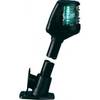
Powerboat Navigation Light, All Round Plug In, 48"
-
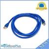
7ft 24AWG Cat6a 500mhz Stp Ethernet Bare Copper Network Cable - Blue
-
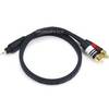
1.5ft Premium 2.5mm Stereo Male to 2rca Male 22AWG Cable
-
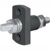
2201 Black Terminal Feed Through Connector
-
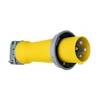
Wiring Device-Kellems M4100P12 Plug, Pin/Sleeve, 100 A
-
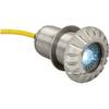
0176DP3CHR LED Thru-Hull Mount Underwater Light - Chrome Plated
-
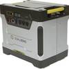
Goal Zero - Yeti 1250 1500w/1200w Portable Solar Generator 31901