ChartKit Book w/ Companion CD - Southern and Centra Map
Model: Brand: Maptech
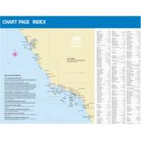
CHARTKIT Book w/ Companion CD Southern and Central California San Francisco to Ensenada, Mexico. Full-color charts, waypoints, courses and distances, marinas, anchorages, chart datums for GPS, and color aerial photos. Save hundreds of dollars on charts. 22 X 17, 71 chart pages. Product Overview New features make ChartKits easy to use with your GPS. Most charts include one-minute lat./long. grids to make vessel positioning a breeze, and major navigation aids are identified with named GPS waypoints. GPS Ready New features make ChartKits easy to use with your GPS. Most charts include one-minute lat./long. grids to make vessel positioning a breeze, and major navigation aids are identified with named GPS waypoints. Small and Large Scale Charts ChartKits include small-scale, wide area charts as well as large-scale, detailed charts of harbors and approaches. The Chart Page Index (inside « less
Product Specification
-
Universal Product Identifiers
Part Number: PAPREGION12
Related Products
-
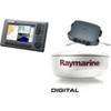
Package(C90W, DSM300G Sounder, 4KW 24 Inch Digital Radome & Radar Cable)
-
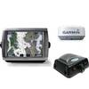
Radar 5212 Package with GMR24HD 4KW Radome & GSD22 Sounder
-
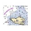
NOAA Rosario Strait-Southern Part Chart
-
6.6 ft DVI cable - dual link 24 pin digital DVI - male - PC
-
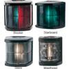
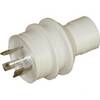
Marine Navigation Lights for Boats to 65'7" Starboard Series
-
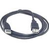
6ft USB 2.0 A Male to A Female Extension 28/24AWG Cable (Gold Plated)
-
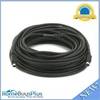
595 50ft S-Video Svideo M/F Extension Cable
-
A5050Y50H Y Adapter - 2 50 Amp 125VAC Connectors -to- 1
-
15 Amp to 30 Amp 125 Volt Hand Adapter White A1530W
-
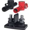
Power Post Dual 2 x 5/16 in. Studs
-
COUP30B 30 Amp Watertight Connecting Coupler Assembly
-
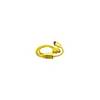
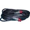
000-0119-86 - N2K Extension Cable, Red Plugs, 15'