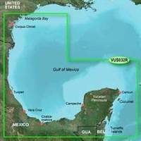
BlueChart g2 Vision - Southern Gulf of Mexico - Maps
Model: Brand: Garmin
BlueChart g2 Vision offers the same rich detailed charting of BlueChart g2 to help you get the most out of your unit. In addition, g2 Vision features a growing database of high-resolution satellite imagery, above and below the water 3D perspective, auto guidance technology, aerial photographs for real world reference and coastal roads with points of interest. This product features detailed coverage of the Gulf of Mexico from Matagorda Bay to Belize City, including Corpus Christi, TX, Veracruz, Mex., the Bay of Campeche, Cancun, Mex., and Cozumel, Mex. « less
Product Specification
-
General
Product Type: MapsDistribution Media: SD Memory CardFirst Seen On Google Shopping: May 2007 -
Compatibility Information
Designed For: Garmin GPSMAP 4008, 4012, 420, 4208, 420s, 4212, 430, 430s, 430sx, 430x, 440, 440s, 440sx, 440x, 450, 5008, 5012, 520, 5208, 520s, 5212, 525, 525s, 530, 530s, 535, 535s, 540, 540s, 545, 545s, 550, 550s, 555, 555s -
Universal Product Identifiers
Part Numbers: 010-C0733-00, Southern Gulf of MexicoGTIN: 00753759069131, 00781573940213
Related Products
-
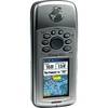
GPSMAP 76Cx - Marine, hiking GPS receiver - 2.6" color - 160 x 240
-
Hydrographical Surveying: A Description of the Means and Methods Employed in Construcing Marine Charts [Book]
-
hi731352 Plastic Tip Set for 2000 L Graduated
-
1" Intake Strainer
-
Minding the Helm: Marine Navigation and Piloting [Book]
-
1.5ft USB 2.0 A Male to A Female Extension 28/24AWG Cable (Gold Plated)
-
75ft 24AWG Cat6 550mhz UTP Ethernet Bare Copper Network Cable - Red
-
000-10531-001 HDS-7 Gen2 Insight USA w/o Transducer
-
25ft 24AWG Cat6 550mhz UTP Ethernet Bare Copper Network 2316
-
GPSMAP 4212 Network Bundle Includes GSD22 & Gxm51 p2683
-
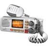
UM380 White VHF Radio Class D UM480
-
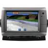
GPSMAP 720 - Marine Chartplotter - 7" color - 800 x 480 - widescreen