BlueChart g2 Vision - California-Mexico - Maps
Model: Brand: Garmin
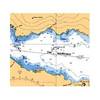
BlueChart g2 Vision offers the same rich detailed charting of BlueChart g2 to help you get the most out of your unit. In addition, g2 Vision features a growing database of high-resolution satellite imagery, above and below the water 3D perspective, auto guidance technology, aerial photographs for real world reference and coastal roads with points of interest. This product features Point Arena to Puerto Vallarta, including Mendocino, San Francisco Bay, Channel Islands, San Diego, and the Baja Peninsula. General coverage for the Mexican coast, including Mazatlan, Acapulco and Salina Cruz. « less
Product Specification
-
General
Product Type: MapsDistribution Media: SD Memory CardFirst Seen On Google Shopping: May 2007 -
Universal Product Identifiers
Part Numbers: 010-C0722-00, California-MexicoGTIN: 00753759069025, 00771623113100 -
Compatibility Information
Designed For: Garmin GPSMAP 4008, 4012, 420, 4208, 420s, 4212, 430, 430s, 430sx, 430x, 440, 440s, 440sx, 440x, 450, 5008, 5012, 520, 5208, 520s, 5212, 525, 525s, 530, 530s, 535, 535s, 540, 540s, 545, 545s, 550, 550s, 555, 555s
Related Products
-
Autopilot Second Station
-
Radar 5208 Package with GMR24HD 4KW Radome & GSD22 Sounder
-
010-C1025-20 Bluechart G2 HXEU718LMediterranean Sea Microsd/sd
-
Quatsino Sound Chart
-
dq2955 25-Watt VHF Class D fixed-flush Mount Marine Radio
-
M604 Grey VHF Radio
-
PFD 33 Gram Manual Inflatable Chest Pak in Navy Size: Large / X-Large
-
LED Navigation Lights, Masthead Tricolor w/ Anchor 65 ft
-
Elite 5M Chartplotter
-
10ft 14AWG Power Cord Cable w/ 3 Conductor PC Power Connector Socket (C13/5-15P) - Black
-
Patch cable - CAT 5e - RJ-45 - M - Unshielded twisted pair (UTP) 50 ft - Gray
-
Medium Deck Seal SS Connector 1.18 Cable .55

