BlueChart g2 Vision - Bretagne - Maps
Model: Brand: Garmin
BlueChart g2 Vision offers the same rich detailed charting of BlueChart g2 to help you get the most out of your unit. In addition, g2 Vision features a growing database of high-resolution satellite imagery, above and below the water 3D perspective, auto guidance technology, aerial photographs for real world reference and coastal roads with points of interest. This product features detailed coverage from Saint-Vaast-la-Hougue to Le Croisic and Belle-Ile, including Cherbourg, the Channel Islands, Saint-Malo, Brest, and Lorient. « less
Product Specification
-
General
Product Type: MapsDistribution Media: SD Memory CardFirst Seen On Google Shopping: June 2007 -
Compatibility Information
Designed For: Garmin GPSMAP 4008, 4012, 420, 4208, 420s, 4212, 430, 430s, 430sx, 430x, 440, 440s, 440sx, 440x, 450, 5008, 5012, 520, 5208, 520s, 5212, 525, 525s, 530, 530s, 535, 535s, 540, 540s, 545, 545s, 550, 550s, 555, 555s -
Universal Product Identifiers
Part Numbers: 010-C0801-00, BretagneGTIN: 00753759069810
Related Products
-
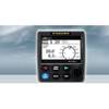
NAVPILOT 711 Autopilot for Inboard without Pumpset
-
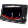
E127 Multifunction 12" Display with Sonar - US Inland Charts T70057 c44354
-
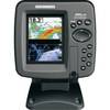
408430-1 385ci Di Combo Fishfinder
-
010-C1023-20 Bluechart G2 HXEU802XMediterranean Sea & Iberian
-
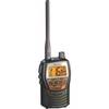
t50421 Marine VHF Hand-Held Radio
-
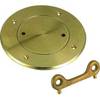
0526003PLB 3" Bronze Deck Plate
-
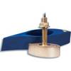
E66079 - 50/200kHz /T, 1KW, BRZ th Xdcr, DSM300
-
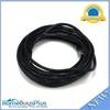
25ft 24AWG Cat6 550mhz UTP Ethernet Bare Copper Network 2316
-
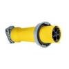
M5100C9R 100A 30Y 120/208V Female Connector
-
Lumishore Thru Hull Flush Fit 18 Watt Blue Underwater Light
-
LTB-SS Stainless Steel Light GPS Bar
-
355 2 Conductor Start Interlock Cable