4125 Map -San Diego/Ensenada
Model: 4125 Brand: Fish-n-Map
FISH-N-MAP UNDERWATER TOPOGRAPHY MAPSMade of waterproof, tear resistant plastic. Features include: underwater depth contours, fish locations, latitude and longitude for GPS, multiple freshwater lakes on one map, boat ramps, recreational facilities and much more.
Product Specification
-
Universal Product Identifiers
Part Numbers: 4125, 7101066GTIN: 00761428041258
Related Products
-
385 Rudder Position Indicator
-
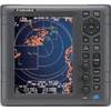
1835 4KW 24" Dome 10. 4" Color LCD Radar
-
DVD - The Boaters Guide to Using Marine Radar N8991DVD
-
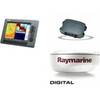
Package(C140W, DSM300G Sounder, 4KW 24 Inch Digital Radome & Radar Cable)
-
NA-C103 (W+95) Erie Ontario & Trent Severn - FP-Card
-
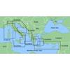
MapSource BlueChart - Ligurian Sea, Corsica and Sardinia - Maps
-
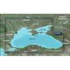
010-C1064-20 G2 HXRU002R Black Sea & Azov Bluechart SD
-
FBRS 2775 Battery Serive Includes 1096 Batt Parts Labor
-
10ft 24AWG Cat5e 350MHz UTP Bare Copper Ethernet Network Cable - Purple
-
10ft 24AWG CL2 Silver Plated High Speed HDMI Cable - Black
-
AS GR16 - Marine GPS receiver
-
3ft 24AWG Cat6 550mhz UTP Ethernet Bare Copper Network Cable - Purple