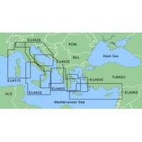
MapSource BlueChart - Ligurian Sea, Corsica and Sardinia - Maps
Model: Brand: Garmin
MapSource BlueChart is Garmin's exclusive marine cartography and was developed to provide you with mapping flexibility and options you've never had before. This line of cartography products is designed to provide interactive viewing of detailed nautical chart data, thereby providing navigators with innovative object-oriented cartography. These detailed electronic nautical charts look just like paper charts when displayed on your Garmin chartplotter. Features include shading between depth contours, spot soundings, navaids, port plans, wrecks, obstructions, inter-tidal zones, and more. BlueChart offers much larger coverage areas for half the price. MapSource BlueChart Ligurian Sea, Corsica and Sardinia provides detailed coverage from Ile du Levant, France to Lido di Ostia, Italy, including complete coverage of Corse and Sardegna. It also includes detailed coverage of Lago Maggiore, Lago D' Iseo, and Lago di Garda in Northern Italy. « less
Product Specification
-
Compatibility Information
Designed For: Garmin eTrex Legend Cx, Vista Cx Garmin GPSMAP 60CSx, 60Cx, 76CSx, 76Cx -
Universal Product Identifiers
Part Numbers: 010-C0438-00, Ligurian Sea, Corsica and Sardinia -
General
Product Type: MapsDistribution Media: microSD Memory CardFirst Seen On Google Shopping: January 2006
Related Products
-
32610 SE-200C Sonar engine
-
C97 Multifunction 9" Display with Sonar - US Inland Charts T70027 c44325
-
Radar 5012 Package with GMR24HD 4KW Radome & GSD22 Sounder
-
SP110RF-4 SP-110 System w/Rudder Feedback & Type T Mechanical D
-
Marinenav Explorer Marine Navigation PC Computer EXP-013-intel
-
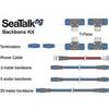
A25062 SeaTalkNG Backbone Cable Kit for ST70
-
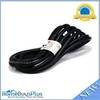
15ft 16AWG Power Cord Cable w/ 3 Conductor PC Power Connector Socket (C13/5-15P) - Black
-
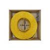
Bulk cable - CAT 5e - Unshielded twisted pair (UTP) 1000 ft - Yellow
-
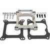
Marine Power 441220 Adapter Plate 262 Holley
-
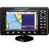
7" GPS CHARTPLOTTER/FF W/MAPS
-
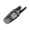
RINO 120 - Hiking GPS receiver / two-way radio - Monochrome
-
AIS Dual Channel Receiver & GPS SR162G