4119 Channel Isls/Venture - Santa
Model: 4119 Brand: Fish-n-Map
FISH-N-MAP UNDERWATER TOPOGRAPHY MAPSMade of waterproof, tear resistant plastic. Features include: underwater depth contours, fish locations, latitude and longitude for GPS, multiple freshwater lakes on one map, boat ramps, recreational facilities and much more.
Product Specification
-
Universal Product Identifiers
Part Numbers: 4119, 516252GTIN: 00761428041197
Related Products
-
TX06S-1 - 6KW, 4' Open Array w/ 20m Cable
-
Package(e97 with aus, NZ, S. America, Asia Chart, 4KW 24 Inch Digital Radome & Radar Cable)
-
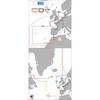
Max EW-M010 MW3 West European Coasts-MAX
-
Sea Charts of the British Isles: A Voyage of Discovery Around Britain & Ireland's Coastline [Book]
-
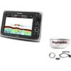
E12169 S1000 Wireless Autopilot System
-
Scanpod Helm Pod for 2 Std. Navigation Instruments/Autopilots, White
-
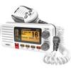
UM415 Oceanus D Marine Radio (White)
-
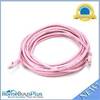
20ft 24AWG Cat5e 350MHz UTP Bare Copper Ethernet Network Cable - Pink
-
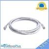
10ft 24AWG Cat6 550mhz UTP Ethernet Bare Copper Network Cable - White
-
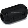
4155 Ferrite cores (1 Pair) for 24AWG HDMI Cable
-
Ram 1.5" Connector
-
Marine Products Plug Wire Set 9-28047