3208 l. Powell So
Model: 3208 Brand: Fish-n-Map
FISH-N-MAP UNDERWATER TOPOGRAPHY MAPSMade of waterproof, tear resistant plastic. Features include: underwater depth contours, fish locations, latitude and longitude for GPS, multiple freshwater lakes on one map, boat ramps, recreational facilities and much more.
Product Specification
-
Universal Product Identifiers
Part Numbers: 250129, 3208GTIN: 00761428032089
Related Products
-
HDS 7 Base Multifunction without Transducer 140-34
-
Rockport to Bangor, Maine Nautical Marine Charts - Waterproof Charts
-
343720122 3720 Series Multivolt White 16 9-31v
-
Cabin Door Hook, Bronze, 1-1/2"
-
AP2403 Autopilot AP24,AC12,RC42,RF300, RPU80
-
T-Top Fold-Down Navigation Boat Light
-
15ft 18AWG Power Cord Cable w/ 3 Conductor PC Power Connector Socket (C13/5-15P) - Black
-
Cat6a Ethernet Cable | 1ft | Orange | Network | 10 Gigabit
-
5ft 24AWG Cat5e 350MHz UTP Bare Copper Ethernet Network Cable - Red
-
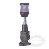
70 Allround Red Nav Light
-
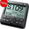
M802 Marine SSB Radio Clear / Ice / Red / Tan
-
Matrix 97 Combo CHO - Marine Chartplotter - 5.6" color - 320 x 240