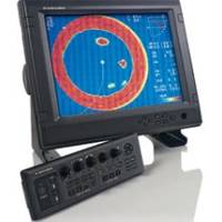
CH270BB/224 180 kHz Black Box Searchlight Sonar System. Includes 250mm Travel Hoist and Operates at 24 and 32VDC
Model: CH270BB Brand: Furuno
Email to us for Price at ask@wmjmarine.com Display Range Frequency Power Output Power Use Supplied Separately 2500' 180 kHz 800 W 24 VDC The CH-270 is a new sophisticated searchlight sonar designed for small fishing vessels or pleasure craft. Individual fish, fish schools and underwater objects are displayed on a 10.4" color LCD. The echograms are displayed in 8 or 16 colors according to received echo strength; the strongest echoes are red, the weakest are blue. One echo can be displayed in white so that a specific echo level is highlighted. The background color is also selectable for optimum viewing day or night. There are eight display modes: full circle scan, zoom, vertical scan, vertical sounder, the combination of full or half circle with vertical scan, full circle with history, full circle with strata and full circle with VideoPlotter. In the vertical scan mode, you can view the vertical plane in any direction around the vessel. The CH-270 features a unique "Cross Section Scan" to view the vertical plane. The CH-270 provides two modes to track a targeted echo: target lock mode and L/L mode. The target lock mode permits automatic tracking of targeted fish schools within a predetermined search zone after it has been manually acquired. In the L/L mode, the beam is locked to the position (such as a fish shelter or reef) chosen with the target marker. This mode can be enhanced with more accurate position input such as DGPS or WAAS. The hull unit will fit any boat where a 147 mm (6") hull tube is available. Also, previously installed CH-18 or 28's can be upgraded to a CH-270 without drydocking since the hull unit is the same. « less
Product Specification
-
Universal Product Identifiers
Part Number: ch270bb224
Related Products
-
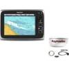
Package(c95 with USA Coastal Chart, 4KW 18 Inch Digital Radome & Radar Cable)
-
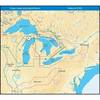
NA-C103 (W+95) Erie Ontario & Trent Severn - FP-Card
-
NT+ Wide Map, Lake Huron/Georgian Bay/North Channel NA-C104
-
The nautical chart [Book]
-
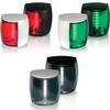
Marine Naviled Pro Port Navigation Light
-
100ft 24AWG Cat6 550mhz UTP Ethernet Bare Copper Network Cable - Green
-
70 Allround Red Nav Light
-
250ft 12AWG CL2 Rated 4-Conductor Loud Speaker Cable (for In-Wall Installation)
-
Power connector adapter - power NEMA L5-30 - M - power NEMA 5-20 - F - PC
-
Marine Products Plug Wire Set 9-28041
-
8027 AC Main + 6 Positions
-
75' Network Cable for Scp Remote Panel 809-0942
