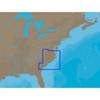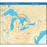
NT+ Wide Map, Lake Huron/Georgian Bay/North Channel NA-C104
Model: NA-C104 Brand: C-Map
C-MAP has set the standard for electronic charts with five consecutive NMEA awards for "Best Electronic Cartography". Built on the incredible success of C-MAP NT+, NT+ Wide combines a generation of chartplotters with efficient performance plus real-time accuracy and detail. Now you will be able to see slip detail as well as the locations for onshore facilities. « less
Product Specification
-
Universal Product Identifiers
Part Number: NA-C104GTIN: 00686074003071
Related Products
-
SP-70MT Autopilot for Cable Steer Tilt Type Helms st70mt
-
SP-70RLP Autopilot System without Pumpset
-
AP-35 Pack 3 Pilot AP35,J300X-40,RF300,RC25
-
010-00738-00 - Radar Pedestal, 6KW XHD
-
300 Series 161 Combo - Marine Chartplotter - 4" monochrome - 240 x 320
-
NA-C310 C-Card Format - Cape May - Winyah Bay
-
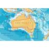
Australia South Platinum Marine Charts on SD Card MSD/61P+
-
Cat6a Ethernet Cable | 5ft | Gray | Network | 10 Gigabit
-
75ft 24AWG Cat6 550mhz UTP Ethernet Bare Copper Network Cable - Yellow
-
100ft 24AWG Cat6 550mhz UTP Ethernet Bare Copper Network Cable - Green
-
Dvid 5M Cable FNavnet 3D
-
E55051 - SeaTalk hs Network Cable, 10M