010-C1020-10 Bluechart G2 HPC024RAustralia & New Zealand Data
Model: 010-C1020-10 Brand: Garmin
See your surroundings more clearly with BlueChart g2 data. With BlueChart g2, you'll get detailed marine cartography that provides convenient viewing of nautical content. BlueChart g2 allows you to see your vessel's precise, on-chart position in relation to naviads, coastal features, anchorages, obstructions, waterways, restricted areas and more. You will also have access to detailed mapping capabilities that include Safety Shading, Fishing Charts, smooth data transition between zoom levels, harmonious transition across chart borders, and reduction of chart discontinuities. Covers: Detailed coverage of the entire continent of Australia and New Zealand. Coverage includes Brisbane, Sydney, and the Great Barrier Reef along the Eastern coast. Coverage continues along the Southern coast including Melbourne, Adelaide, and Tasmania through the Great Australian Bight. Coverage also includes Perth, Geraldton, Darwin, and the Gulf of Carpentaria on the Western and Northern coasts. « less
Product Specification
-
Universal Product Identifiers
Part Numbers: 010-C1020-10, 10807220, 35813GTIN: 00753759095482
Related Products
-
AP5014 Autopilot with AP50, J50, Rudder Feedback RF300, HLD2000LD (Long Stroke, Dual Drive)
-
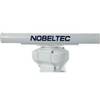
IR2 4.4 4KW 4.5 Foot Open Array Radar R-0006
-
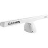
K10-00012-07 GMR 406 XHD 4KW Pedestal & 6ft Open Array
-
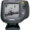
500 Series 525 - Fishfinder - included transducer : XNT-9-20-T - single-beam
-
PAPR06; Region 6 Paper Chart Kit
-
HDS 5x Gen2 - Fishfinder
-
1ft 24AWG Cat5e 350MHz UTP Bare Copper Ethernet Network Cable - Orange
-
GC7267 Stranded Cat6 RJ45 Plug (100-Pack)
-
10ft RG6 (18AWG) 75OHM, Quad Shield, CL2 Coaxial Cable with F Type Connector - White
-
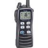
ic-m7201 M72, 6/3/1 Watt, 15 Hr. Batt, Floats
-
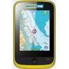
Memory-Map Adventurer 3500 GPS - Marine -Yellow/Black
-
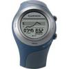
Forerunner 405CX - Running GPS receiver - Monochrome - 124 x 95