010-C1002-20 Bluechart G2 HXEU059RGreenland East Microsd/sd ADA
Model: 010-C1002-20 Brand: Garmin
See your surroundings more clearly with BlueChart g2 data. With BlueChart g2, you’ll get detailed marine cartography that provides convenient viewing of nautical content. BlueChart g2 allows you to see your vessel’s precise, on-chart position in relation to naviads, coastal features, anchorages, obstructions, waterways, restricted areas and more. You will also have access to detailed mapping capabilities that include Safety Shading, Fishing Charts, smooth data transition between zoom levels, harmonious transition across chart borders, and reduction of chart discontinuities. Covers: Detailed coverage of the Eastern coast of Greenland from Germania Land around the southern tip of Greenland to Godthab (Nuuk) on the SW coast: Also details Jameson Land, Ammassalik, Julianehab (Qaqortoq), and Nanortalik. « less
Product Specification
-
Universal Product Identifiers
Part Numbers: 010-C1002-20, 10807212, 35804GTIN: 00753759090340
Related Products
-
NAVPILOT 700 Autopilot for Inboard without Pumpset
-
000-10619-001 Triton Pilot Add-on System - High Current
-
Motor/Sonar Connector Plug
-
T62291 C Series Widescreen System Packs
-
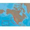
NaM024 CCard Format u.s.west Coast and Hawaii
-
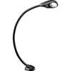
Marine Flexible LED Chart Table Lamp 9353723
-
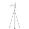
M504 Remote Mic Version - Black
-
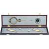
319 Elegant Navigation Set
-
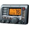
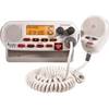
Marine RADIO-FIX VHF Class-D DSC White (143-MRF45D)
-
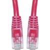
Cat6a Ethernet Cable | 5ft | Red | Network | 10 Gigabit
-
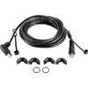
Split Connector 20ft Right Angle RJ45 Plug
-
Air Marine Tower Hardware Kit