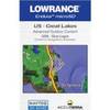
010-C0787-20 Bluechart G2 HXEU051RLista - Sognefjorden microSD
Model: 010-C0787-20 Brand: Garmin
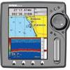
See your surroundings more clearly with BlueChart g2 data. With BlueChart g2, you'll get detailed marine cartography that provides convenient viewing of nautical content. BlueChart g2 allows you to see your vessel's precise, on-chart position in relation to naviads, coastal features, anchorages, obstructions, waterways, restricted areas and more. You will also have access to detailed mapping capabilities that include Safety Shading, Fishing Charts, smooth data transition between zoom levels, harmonious transition across chart borders, and reduction of chart discontinuities. Covers: Detailed coverage of the Norway coast from Farsund to Sognefjorden, including the Shetland Islands. Includes detailed coverage of Bergen, Haugesund and Stavanger. « less
Product Specification
-
Universal Product Identifiers
Part Numbers: 010-C0787-20, 10805356, 35646GTIN: 00753759091965
Related Products
-
SP-70MT Autopilot for Cable Steer Tilt Type Helms st70mt
-
408430-1M 385cxi Di Fishfinder GPS Combo - International Un
-
Mr F75B-D Marine Class-D Digital Selective Calling Technolo
-
37555 Outdoor US Great Lakes Chart f/Endura Series
-
3206 Lake Mohave
-
Electronics PC-27BL Power cable - PC
-
EC5EF 5 Inch GPS Chartplotter Fishfinder Combo External Antenna
-
MMC-00821 Small Water Tight Connector
-
Supply TC44984 Trailer Connector Adapters 7 Pole
-
Marine Products Plug Wire Set 9-28034
-
Power Heavy Duty Docking Replacement Light Only, Black, 12V
-
8059 Panel 120VAC 8 Circuit Breaker